Loading…
Places
53 places to discover in Cappadocia
AllCastlesChurches & MonasteriesHistorical SitesMuseumsNatureOpen Air MuseumTransportUnderground CitiesValleysViewpoints
53 results
Historical Sites
Açıksaray Ruins
Açıksaray, the "Open Palace," is a sprawling Byzantine rock-cut complex of monasteries, churches, and dwellings carved into volcanic cliffs near Gülşehir. Despite the name, this was never a single palace. Açıksaray is a scattered group of rock-cut courtyards, chapels, refectories, and storage rooms hewn into the pale tuff cliffs of a shallow valley between Nevşehir and the little town of Gülşehir, in the northwest corner of Cappadocia. Archaeologists believe the complex was carved and used mainly between roughly the 9th and 11th centuries, when this was a busy monastic and rural settlement zone. The most striking survivors are the grand façades: whoever cut these fronts imitated built architecture in the living rock, chiselling blind arches, horseshoe arcades, columns, and even carved cornices straight into the stone. That decorative ambition is what makes Açıksaray special. You are looking at Byzantine builders showing off, working in a medium that could not be quarried or assembled but only carved away. What you will actually see is a series of numbered courtyard units strung along the cliffs, each once serving as a self-contained monastic or manor-house group. Wander between them and you find refectories with rock-cut tables, small barrel-vaulted churches, tombs, pigeon niches, and dim cave rooms that were kitchens, stables, or granaries. The carving detail on the best façades is genuinely fine, with delicate mouldings framing doorways and windows. Just outside the main cluster stands the site's other star: a tall, elegant mushroom-shaped fairy chimney, a slender stem crowned by a broad dark cap of harder rock. It is one of the most photogenic single rock formations in the whole region, and here you will often have it entirely to yourself. Açıksaray sits right beside the Nevşehir–Gülşehir road, about 20 kilometres northwest of Nevşehir and only a few kilometres short of Gülşehir town. There is no dedicated dolmuş stop at the ruins themselves, so the easy options are to drive, take a taxi, or catch a Nevşehir–Gülşehir minibus and ask the driver to let you off near Açıksaray, then walk in. Minibuses between Nevşehir and Gülşehir run through the day but are not frequent, so if you rely on one, note roughly when the next return passes. Coming from Göreme or Ürgüp, you will first head to Nevşehir and change there. Many visitors fold Açıksaray into a half-day loop that also takes in Gülşehir's superb St. Jean (Karşı Kilise) frescoes and the salty crater of Nar Lake nearby. The site is open-air and best enjoyed in the softer light of morning or late afternoon, when the carved façades catch shadow and the tuff glows warm. Midday summer heat is fierce and there is little shade, so bring water and a hat. Spring and autumn are ideal. Plan on roughly 45 minutes to an hour to walk the courtyards and reach the mushroom rock, more if you like to poke into every cave and take photographs. A few honest tips. Açıksaray is refreshingly wild and uncommercial, which is exactly its charm, but that also means facilities are minimal to nonexistent, so use the toilets in Gülşehir or Nevşehir first. Wear proper shoes: the ground is uneven, some chambers have low ceilings and loose rubble, and a small torch helps in the darker rooms. Do not climb on fragile carved façades or into unstable-looking cavities, both for your safety and to protect the site. There may be a small entrance fee and simple signage; hours are generally daytime, opening in the morning. Because so few tour buses come here, you get a rare thing in Cappadocia: a monumental medieval site experienced in near-silence, on your own schedule, with the mushroom chimney standing quietly against the sky.
Historical Sites
Ağzıkarahan Caravanserai
Ağzıkarahan Caravanserai is a monumental Seljuk roadside inn built in 1231, one of the best-preserved on the old Silk Road between Aksaray and Nevşehir. If you want to understand how medieval trade actually worked, this is one of the most rewarding stops in the wider Cappadocia region, and it usually has hardly anyone else around. A caravanserai was a fortified inn where camel caravans carrying silk, spices, and goods could stop for the night, rest their animals, repair harnesses, and sleep in safety. The Seljuk sultans built a whole chain of them roughly a day's walk apart, and travellers could stay for up to three nights free of charge. Ağzıkarahan is one of the grandest survivors of that system, and standing inside it you can genuinely picture the courtyard full of loaded camels, merchants, and traders from a dozen different lands. The building was begun under Sultan Alaeddin Keykubad I and finished around the mid-13th century, and its scale is what surprises most people. You approach a huge, deeply carved stone portal with the geometric stalactite-style stonework the Seljuks were famous for. Beyond it opens a broad open courtyard ringed with arcaded rooms and stables where animals and lower-status travellers stayed in the warmer months. At the very centre sits the caravanserai's signature feature, a small raised mosque (called a köşk mescit) perched on four arches, so worshippers could pray above the bustle of the yard. At the back, a vast vaulted covered hall runs deep into the building; this was the winter section, sheltered and warm, where everyone crowded in during the cold Anatolian months. The stonework throughout, the ribbed vaults, the carved capitals, the honeycombed doorway, is exceptional and remarkably intact. Ağzıkarahan sits about 15 kilometres east of Aksaray, right on the historic Aksaray to Nevşehir road, beside the small village that shares its name. It is not in the core Göreme–Ürgüp valley cluster, so the honest truth is that the easiest way to reach it is by car, and it makes a perfect stop on the drive between Cappadocia and the Ihlara Valley or Aksaray. If you are relying on public transport, take a minibus or dolmuş along the Nevşehir–Aksaray route and ask the driver to let you off at Ağzıkarahan; from the highway it is a short walk to the site, but return connections can be sparse, so plan your timing and be ready to flag down a passing minibus. Many visitors pair it with Sultanhanı, the enormous caravanserai further west near Aksaray, for a proper Silk Road day. There is a small entrance fee, and the site generally opens in the morning and closes in the late afternoon, with shorter hours in winter. Allow around 30 to 45 minutes to walk the courtyard, climb up to the little mosque, and explore the covered hall. Photographers should come in the early morning or late afternoon, when low sun rakes across the carved portal and throws the stonework into deep relief. Midday light is flatter and the courtyard can get hot in summer. A few honest tips. The covered hall is dim, so let your eyes adjust and watch your footing on the worn stone. Bring water, as there is little shade and no café on site; the village nearby is tiny. There is not much signage or interpretation, so reading a little about Seljuk caravanserais beforehand makes the visit far richer. It is quiet and atmospheric precisely because it is off the main tourist trail, so you often get the whole place to yourself. If you only have time for one caravanserai and you are staying in the heart of Cappadocia, the smaller Sarıhan near Avanos is far closer; but if you are already driving toward Aksaray or Ihlara, Ağzıkarahan is the bigger, more complete, and more memorable monument, and well worth the detour.
Historical Sites
Çavuşin Old Village
Çavuşin Old Village is a half-abandoned cliff village between Göreme and Avanos where hollowed cave houses cling to a tall rock face beneath one of Cappadocia's oldest churches. It is one of those places that stops you the moment the road curves and the cliff comes into view. A whole village is carved straight into the pale stone, its dark windows and doorways stacked up the face like a honeycomb, and almost all of it is empty. People lived here for centuries, cutting rooms, pigeon lofts, storerooms and stables into the soft tuff. Then, through the twentieth century, rockfalls made the upper dwellings unsafe, and over time the families moved down to the modern village of Çavuşin at the foot of the cliff. What they left behind is not a museum in the polished sense but a village frozen mid-abandonment, quiet and slightly haunting, with far fewer visitors than the big open-air museums nearby. The reward for anyone willing to scramble up is the Church of St. John the Baptist, hidden high on the rock and thought to be among the earliest in the whole region, with roots reaching back to the fifth century. It is one of the oldest surviving churches in Cappadocia, and standing at its worn threshold with the valley spread out below is the sort of moment that stays with you. Down by the road there is a second, separate church, usually called the Çavuşin Church or the Church of Nicephorus Phocas, which preserves faded but striking frescoes said to commemorate a Byzantine emperor's passage through the region in the tenth century. Beyond the churches, the pleasure here is simply wandering. You can peer into abandoned cave homes, follow worn footpaths between the ruins, and look out over apricot orchards and vineyards toward the fairy chimneys. Çavuşin is also the natural trailhead for the Rose Valley and Red Valley hikes, so many walkers use it as a gateway to some of the finest scenery in Cappadocia, ending their walk here as the light turns golden. Getting to Çavuşin is easy. It sits right on the Göreme to Avanos road, only about three kilometres from Göreme. The Göreme-Avanos minibus, the dolmuş, passes through and can drop you at the village; it runs frequently through the day in season. A taxi is quick and cheap, and if you enjoy walking you can reach Çavuşin from Göreme on foot in under an hour through the valleys. From Ürgüp or Nevşehir, take a minibus toward Göreme first and change there, or come by car. Most valley tours also make a stop. Come at almost any time of day, though the low light of early morning and late afternoon flatters the honey-coloured cliff and is far kinder for photographs. Allow around forty-five minutes to an hour for the old village and its churches, and much longer if you plan to link it with a valley walk. Midday in summer is hot and shadeless on the rock, so bring water and a hat. A few honest tips before you go. The old cave houses are genuinely unstable, so look and photograph but do not climb into anything that feels precarious, and keep small children close. The path up to the Church of St. John the Baptist is steep, loose and exposed in places, so proper shoes with grip make a real difference and it is best skipped in wet weather. The frescoed lower church usually charges a small entrance fee, so carry a little cash. There is not much shade and only a handful of small shops and cafés in the modern village below, so stock up beforehand. Treat the site with the same respect you would any historic ruin: it is fragile, beautiful, and best left as you found it.
Churches & Monasteries
Dark Church
The Dark Church, or Karanlık Kilise, holds the best-preserved Byzantine frescoes in all of Cappadocia, saved by the very darkness inside it. Tucked into the far corner of the Göreme Open Air Museum, this small rock-cut chapel earned its name from its near-windowless design. Where sunlight has faded and flaked the paintings in almost every other Cappadocian church, here a single tiny opening let in so little daylight that the pigments barely aged. Step inside and you see something that feels almost impossible: deep lapis blues, warm reds, and glinting gold backgrounds that look as fresh as if they were painted a generation ago rather than nearly a thousand years back. For many visitors it is the single most striking moment in Cappadocia. The frescoes date to around the 11th century, when the Dark Church was part of a small monastic complex carved into the tuff. Its walls and domed ceiling carry a full cycle of Gospel scenes: the Nativity, the Journey to Bethlehem, the Baptism, the Last Supper, the Betrayal of Judas, the Crucifixion, and the Anastasis, along with a magnificent Christ Pantocrator gazing down from the central dome. For centuries the chapel was used as a pigeon house, and layers of droppings and soot ironically helped shield the paintings. A long and careful restoration removed that grime and revealed the intact program you see today, which is why art historians consider these among the finest Byzantine frescoes surviving anywhere. Getting here is simple, because the Dark Church sits inside the Göreme Open Air Museum, one of Cappadocia's flagship sights. From Göreme village center it is a very pleasant uphill walk of roughly ten to fifteen minutes, or a two-minute drive. From Ürgüp and Nevşehir, frequent dolmuş minibuses run through Göreme, so you can hop off in the village and walk up, or stay on toward the museum stop. Once inside the museum, follow the marked circuit; the Dark Church is one of the last chapels on the loop and is clearly signposted. Note that it needs a separate small ticket on top of general museum admission, paid right at the church entrance, so keep some extra cash handy. The Museum Pass Cappadocia can be a good value if you are visiting several sites. Inside, the space is intimate and can hold only a few people at a time, so a short queue often forms, especially in the middle of the day when tour groups arrive together. Photography is not allowed inside in order to protect the fragile pigments, and this is enforced, so simply take a few quiet minutes to look up at the dome and let your eyes adjust to the low light. That dimness is part of the experience; give it a moment and the colors seem to deepen. The best time to visit is right at opening in the morning or in the last hour of the afternoon, when the museum is quieter and the queue for the chapel is shortest. You only need about ten to fifteen minutes inside the Dark Church itself, but budget one and a half to two hours for the whole museum so you are not rushing. Spring and autumn bring the most comfortable weather; summer middays are hot with little shade along the museum paths. A few honest tips make the visit smoother. Bring small banknotes for the separate ticket, as card payment at the church door cannot be relied upon. Wear shoes with grip, because the rock steps and worn stone can be slick. On your way out, do not miss the Tokalı Church just across the road from the museum exit; it is covered by your museum ticket and is easy to walk past. If the Dark Church queue looks long when you arrive, do the rest of the museum circuit first and come back, since crowds thin as tour buses move on. Finally, treat the chapel as the working sacred space it once was, keep your voice low, and give the frescoes the unhurried attention they have earned across a thousand years.
Underground Cities
Derinkuyu Underground City
Derinkuyu is Cappadocia's deepest underground city, plunging roughly 85 metres through as many as eighteen carved levels. Set beneath the quiet town of the same name about 29 kilometres south of Nevşehir, this is the most staggering of all the region's underground cities, precisely because of its scale and depth. Where the short version says eight floors and room for 20,000 people, the reality on the ground is even more humbling: a vertical labyrinth of stairwells, ventilation shafts, stables, kitchens, cellars, a wine and oil press, and near the bottom a cool, barrel-vaulted hall widely believed to have served as a religious school or church. Eight levels are open to visitors today, and the descent is genuinely deep. The story below is one of ingenuity born of danger. Carved and enlarged over many centuries into the soft volcanic tuff, Derinkuyu sheltered early Christian communities hiding from raids and armies passing through Anatolia. Each level could be sealed off from within by massive circular rolling-stone doors that only the people inside could move. A single ventilation shaft, doubling as a well, runs more than 50 metres down, which is how thousands of people, along with their animals and food stores, could survive underground for long stretches. Much of the complex was forgotten for generations and famously re-entered the historical record in 1963, when a local resident is said to have knocked through a wall in his house and discovered a passage leading into the vast hidden network. Walking through, you descend past level after level while the daylight vanishes and the air holds at a steady, cool temperature. You will see the deep well shaft, the rolling stone doors guarding each floor, blackened kitchen ceilings, storage rooms, animal stables near the surface, and that large cruciform hall on a lower level. It is claustrophobic in places, and honest travellers should know it: some connecting tunnels are low and narrow, and short stretches are walked completely crouched over. This is not the place for anyone with serious claustrophobia, heart or breathing trouble, or very small children who tire quickly on steep stairs. Getting there is easy enough. From Nevşehir, about 29 kilometres away, frequent minibuses (dolmuş) run south toward Niğde and stop at Derinkuyu, dropping you a short walk from the entrance in the town centre. From Göreme or Ürgüp there is no direct minibus, so most visitors come by car, taxi, or on a guided Green Tour, which typically bundles Derinkuyu with the Ihlara Valley, Selime, and often nearby Kaymaklı Underground City, roughly 10 kilometres north and thought to connect to Derinkuyu by a long tunnel. By car from Göreme it is around 45 minutes. Aim to arrive right at opening in the morning. The stairwells are single-file and back up quickly once the coach groups arrive, so an early start means you descend in relative calm rather than shuffling nose-to-tail. The constant cool temperature also makes Derinkuyu a perfect refuge on blazing summer afternoons. Most people spend between 45 minutes and 75 minutes inside, though photographers and history lovers can happily stretch it longer. A few honest practical tips. There is a small entrance fee, and it opens in the morning, so build your day around a morning or early-afternoon visit. Bring a light layer, because the depths stay cool year-round no matter how hot it is above. Wear sturdy shoes with grip, since the worn steps can be slick. Remember that the climb back up is the genuinely tiring part, so pace yourself and rest on the way out rather than rushing. If tunnels underground make you uneasy, the wider, slightly shallower Kaymaklı nearby is a gentler alternative. Either way, Derinkuyu offers one of the most unforgettable, almost cinematic experiences in all of Cappadocia, a reminder of just how resourceful and resilient the people who carved this hidden world truly were.
Valleys
Devrent (Imagination Valley)
Devrent, the Imagination Valley, is a short, surreal valley near Cappadocia's Avanos-Urgup road where wind-carved rocks look like animals and figures. Locals nicknamed it Hayal Vadisi, the Valley of Imagination, and the name fits perfectly. Unlike almost every other valley in Cappadocia, Devrent has no cave churches, no rock-cut houses, and no old vineyards tucked between the cones. Nobody ever settled or farmed here. That absence is exactly what makes it special: the soft volcanic tuff has been left entirely to the wind and rain for millions of years, so the erosion patterns stand out clean and uninterrupted. What you get is pure geology and a bit of a game, staring at the stone until the shapes reveal themselves. The star of the valley is the famous camel rock, a formation that genuinely looks like a camel resting on the plateau, complete with a curved neck and hump. It is one of the most photographed natural sculptures in the whole region. Once your eye tunes in, you will start seeing more: dolphins, a seal, a snake, and what many people call the kissing birds or ducks. There is no single correct answer, which is part of the charm. Half the fun is arguing gently with whoever you came with about whether that shape is a dolphin or a whale. Geologically, this is the same story as the rest of Cappadocia. Ancient eruptions from Mount Erciyes and Hasan laid down thick layers of ash that hardened into tuff, then softer and harder layers eroded at different rates. Where a cap of tougher rock protected the softer stone beneath it, you got fairy chimneys and, here, these odd animal silhouettes. Devrent is a compact, open showcase of that process. Getting here is easiest by car or on a tour, because Devrent sits right on the Avanos to Urgup road, very close to Pasabag (Monks Valley) and the Zelve Open-Air Museum. Most standard Cappadocia group tours, often sold as the Red Tour, include a stop here. If you are driving from Goreme it is roughly a fifteen to twenty minute trip; from Urgup or Avanos it is even quicker. Public transport is trickier. Dolmus minibuses run between the main towns but do not reliably drop you right at the valley, so if you rely on them plan to combine Devrent with nearby stops or expect a walk along the roadside. A taxi from Urgup or Goreme is a reasonable option if you want to link a few close sites in one loop. Plan on a short visit, roughly twenty to forty minutes. This is a viewpoint valley rather than a hiking destination. The walking is flat and easy, suitable for all ages and comfortable even for grandparents and small children, so it makes a relaxed contrast to the steeper trails at Rose Valley or Love Valley. Because it is quick, Devrent works best bundled with Pasabag and Zelve, which are minutes away, and often with the Three Beauties near Urgup. For the best experience, come in the early morning or late afternoon. Soft, low light throws longer shadows across the formations and makes the animal shapes far easier to pick out, and it also spares you the harsh midday glare in photos. Midday tour buses can crowd the small parking area, so an early start rewards you with quieter paths. A few honest tips. Facilities are minimal here, so use the toilets at Pasabag or Zelve and bring your own water, especially in summer when there is very little shade. There is sometimes a modest entrance or parking fee, and small vendors may set up stalls, so carry a little cash. Wear comfortable shoes, though nothing technical is needed. And manage expectations: Devrent is charming and photogenic, but it is a brief, light stop, not a half-day adventure. Treat it as a delightful ten-minute wonder within a larger day of exploring, and you will leave smiling.
Valleys
Devrent Valley
Devrent Valley, nicknamed Imagination Valley, is a Cappadocia landscape where wind-carved rocks look like animals, with no churches or cave homes. That single fact makes Devrent unlike almost every other valley in the region. Everywhere else in Cappadocia, people hollowed out the soft volcanic tuff to build houses, pigeon lofts, monasteries and rock-cut churches. Devrent was left alone. No one settled it, no one farmed it, and no one carved into it. What you get instead is pure geology: millions of years of wind, rain and frost slowly sculpting the pale rock into shapes your brain can't help but read as living creatures. That is why locals and guides call it Hayal Vadisi, the Valley of Imagination. The most famous formation is the camel. Standing near the entrance, it really does look like a resting dromedary, hump and neck and all, and it is the photo everyone comes for. But the fun of Devrent is that the camel is only the start. Look longer and you will pick out shapes that resemble dolphins, seals, snakes, a kissing couple, even the Virgin Mary depending on who is pointing. There are no official signs telling you what to see, which is exactly the point. Two people can stand in the same spot and see completely different things. Bring a bit of playfulness and you will get far more out of it than from any plaque. The landscape itself is otherworldly, sometimes described as lunar. The tuff here is lighter and smoother than in the fairy chimney valleys, and because nothing was ever built on it, the erosion patterns stand out cleanly. It is a small valley, more of a viewpoint and a short stroll than a proper hike, so it suits absolutely everyone, including families with kids and travellers who don't want to climb. Getting there is easiest on the Avanos to Ürgüp road, where Devrent sits very close to Paşabağ (Monks Valley) and the Zelve Open-Air Museum. From Göreme, most people reach it by car, taxi, scooter or as a stop on the classic Red Tour, which links Devrent, Paşabağ, Zelve and the Three Beauties viewpoint in one loop. If you are on public transport, minibuses (dolmuş) run between Göreme, Avanos and Ürgüp, but they won't drop you exactly at the valley, so a taxi for the last stretch or a half-day tour is the simpler option. From Ürgüp it is a short drive north; from Nevşehir you'll head toward Avanos and follow signs for Devrent. Timing matters mostly for light and crowds. Early morning and late afternoon give the rocks a warmer, softer glow that makes the animal shapes pop, and you'll share the site with fewer tour buses. Midday is fine too, just brighter and busier. Because there is no shade to speak of, summer visits are hot, so a hat, sunscreen and water are worth having. You don't need long here. Twenty to forty minutes is enough to walk the short path, find the camel, hunt for a few other shapes and take your photos. A few honest tips. Devrent is essentially a roadside natural site, so don't expect a proper visitor centre, cafe or reliable toilets. There may be a small entrance fee at times, but it is a low-key spot rather than a ticketed museum, and facilities are minimal, so plan food and bathroom stops around it. Wear comfortable shoes; the walking is easy and flat, but the ground is uneven in places. And treat Devrent as one bead on a string rather than a destination in itself. Paired with Paşabağ's fairy chimneys and the abandoned rock village of Zelve just up the road, it becomes a lovely, low-effort half day that shows off Cappadocia's stranger, quieter side. Go with your imagination switched on, and Devrent rewards you.
Nature
Erciyes Mountain
Mount Erciyes is the snow-capped 3,916-metre volcano near Kayseri whose ancient eruptions created the soft rock of Cappadocia. You can see it from almost anywhere in the region: a great pale pyramid rising on the eastern horizon, holding snow long after the valleys have turned green. Erciyes Dağı, as it is known in Turkish, is an extinct stratovolcano and the tallest mountain in central Anatolia. Millions of years ago it erupted again and again, blanketing the whole area in volcanic ash and lava. That ash hardened into the soft tuff that wind and water later carved into the fairy chimneys, valleys and cave dwellings that make Cappadocia famous. In a very real sense, the mountain you see in the distance is the parent of every rock formation you will photograph up close. The mountain has always loomed large in local imagination. The Romans called it Argaeus and stamped its image on their coins; ancient geographers wrote that from its summit you could glimpse two seas on a clear day, a beautiful exaggeration that captures how commanding it feels. For the people of Kayseri it remains a source of pride and a natural weather clock, its cap of snow marking the turn of the seasons. Today Erciyes has two lives. In winter it becomes central Turkey's largest ski resort, with modern gondolas and chairlifts, long groomed runs and reliable snow from roughly December to April. Skiers and snowboarders of every level come here, and even non-skiers ride the lifts for the views or warm up in the cafes at the base. In the warmer months the crowds thin and the mountain belongs to hikers, mountaineers and photographers. Well-equipped, fit walkers tackle the trails toward the summit, though the very top is a serious climb best attempted with a guide and proper gear. Lower down, the alpine meadows, crater lakes and huge open skies are reward enough for a gentle day out. Getting there takes a bit of planning, because Erciyes sits on the Kayseri side of the region rather than in the Göreme core. From Göreme, Ürgüp or Nevşehir the drive is roughly an hour to an hour and a half by car, and a rental car or a private transfer is by far the easiest option. There is no direct tourist minibus from the Cappadocia villages to the ski base, so if you do not have a car, ask your guesthouse to arrange a transfer or join a day tour. During ski season, shuttle services and buses run from the city of Kayseri, which also has its own airport, so some visitors combine a Kayseri arrival with a day on the slopes. The best time to visit depends entirely on what you want. Come between December and March for snow and skiing, when the resort is at its liveliest. Come in late spring through early autumn for hiking, clear panoramic views and cool mountain air that is a relief from the summer heat down in the valleys. A half day is enough to ride the lifts, take in the scenery and have lunch; a full day lets you ski properly or complete a longer hike. Serious summit attempts need an early start and, ideally, an overnight nearby. A few honest tips. The weather up here changes fast and it is always colder and windier than in Göreme, so bring warm layers even in summer and check conditions before you set out. In winter you can rent skis, boards and clothing at the base if you do not have your own. Altitude is real, so pace yourself and drink water. If your priority is the classic fairy-chimney sightseeing, you may decide Erciyes is a special add-on rather than a must-do, since it is a detour from the main valleys. But if you love mountains, snow or a good origin story, standing on the volcano that literally made Cappadocia is an experience the postcard views cannot match.
Valleys
Gomeda Valley
Gomeda Valley is a quiet, rarely-crowded Cappadocia canyon lined with Byzantine rock-cut dwellings, chapels and storage rooms, perfect for hikers craving solitude. Winding through the tuff country around Çavuşin, Gomeda is the kind of valley most visitors never reach. While crowds fill the Rose, Love and Pigeon valleys, this long, sheltered canyon stays almost empty, which is exactly its charm. If you have already ticked off Cappadocia's famous walks and want a stretch of trail where the loudest sound is your own footsteps and the wind moving through the poplars, this is the place to come. The story here is written into the rock. For centuries local communities carved homes, chapels and deep storage rooms straight into the soft volcanic walls, and many of these Byzantine-era chambers survive. As you walk you will pass cave dwellings with soot-darkened ceilings, niches cut for oil lamps, doorways worn smooth by generations, and small rock-cut churches whose faded traces of paint still cling to the apse. Some cavities were pigeon houses, their entrances speckled with old plaster the farmers used to attract birds, whose droppings fertilised the vineyards and orchards below. It is unpolished, unrestored and genuinely atmospheric, the opposite of a manicured open-air museum. What you will do here is simply walk and look. The valley floor is green and gentle in places, following a seasonal streambed past fruit trees, wild rose and scrubby vineyard terraces, then narrowing between honey-coloured cliffs pocked with black cave mouths. Bring a torch if you want to peer into the darker chambers, and watch your footing, because paths are natural, sometimes muddy, and not signposted. There is a real sense of discovery in tracing which caves connect and which chapels hide around the next bend. Getting here takes a little effort, which is part of why it stays quiet. The nearest village is Çavuşin, roughly midway between Göreme and Avanos. From Göreme you can take one of the frequent Avanos-bound minibuses (dolmuş) and ask to be let off near Çavuşin, then walk in toward the valley mouth. From Avanos or Ürgüp the same minibus network gets you to Çavuşin easily, and drivers are used to walkers. Many hikers reach Gomeda on foot as an extension of the Çavuşin–Zelve area rather than driving, though if you have a car you can park near the village and set off from there. A taxi from Göreme or Ürgüp is a simple fallback if you are short on time. The best time to visit is spring or autumn, when the light is soft, the orchards are in blossom or turning gold, and the temperature suits a couple of hours of walking. Summer middays are hot and shadeless on the exposed sections, so start early or go late in the afternoon for gentler sun and better photographs. Winter can be beautiful and utterly deserted, but the trail turns slippery after rain or snow. Plan on two to three hours for a relaxed there-and-back walk, or half a day if you like to explore every cave and sit a while. A few honest tips. There is no ticket booth, no café and no toilets, so carry your own water and snacks and pack out everything you bring. Wear proper shoes with grip rather than sandals, and do not rely on phone signal deep in the canyon. The rock is soft and some ceilings are fragile, so treat the churches and dwellings gently and resist the urge to climb where the tuff looks crumbly. Because the route is unmarked, it is worth downloading an offline map or, better still, going with someone who knows the valley if you are nervous about navigation. Finally, respect the working orchards and vineyards you pass, as this is still living farmland, not just a ruin. Come to Gomeda for the quiet, for the honest thrill of finding a thousand-year-old chapel with no rope, no crowd and no entrance fee, and for the simple pleasure of walking through one of Cappadocia's most peaceful corners. It rewards the traveller willing to step a little off the beaten path.
Transport
Göreme Bus Station
Göreme Bus Station is the small central otogar where nearly every Cappadocia journey begins, ends, or connects. It sits right in the heart of the village, an easy walk from most cave hotels, pensions, and the main strip of cafés and tour offices. It is not a place you visit for its beauty, but you will pass through it constantly, and knowing how it works quietly makes your whole trip smoother. Despite the grand word otogar, this is a modest, friendly hub rather than a sprawling terminal. You will find a cluster of small ticket offices belonging to the intercity bus companies, a few simple cafés and kiosks, benches, and the loading bays where the local dolmuş minibuses idle. There is usually a helpful staff member or driver who will point you to the right vehicle if you look lost, and the whole thing is compact enough that you can take it in at a glance. The station's main daily role is as the launch point for dolmuş minibuses, the shared minivans that are the cheapest and most authentic way to move around Cappadocia. From here regular services run to Nevşehir, the provincial capital, often passing through Uçhisar and Ortahisar on the way. Another well-loved line heads north toward Avanos, stopping near Çavuşin, Paşabağ, and the Zelve area, which makes it a favourite for reaching the open-air valleys without a tour. Services also connect toward Ürgüp. You generally pay the driver or conductor in cash on board, and there is no need to book in advance. For longer journeys, the picture is a little different. Overnight and daytime intercity coaches to Ankara, Istanbul, Izmir, and other cities do not usually run directly from tiny Göreme. Instead you travel the short distance to the much larger Nevşehir bus terminal, from where the big coaches depart. The good news is that most reputable bus companies include a free servis, a shuttle minibus that carries you between Göreme and the Nevşehir terminal at no extra cost. When you buy a long-distance ticket, always ask whether the free servis is included and where it picks you up, as this saves both money and confusion. Getting to the station itself is simple. From anywhere in Göreme it is a short, flat walk, rarely more than five to ten minutes from the accommodation clusters. Coming from Ürgüp or Nevşehir, you can arrive on the same dolmuş network that departs from here, so the station doubles as your gateway into the village. Arriving from Nevşehir Kapadokya Airport, most people use a pre-booked hotel transfer or the shuttle services, which drop you close to this central point. The best time to use the station is during daylight and mid-morning to early afternoon, when dolmuş frequencies are highest. Services thin out noticeably in the evening, on Sundays, and during the quieter winter months, so it pays to check the last departure if you are heading out to a valley or village. You will rarely spend more than a few minutes here beyond waiting for your minibus, though it is a pleasant enough spot to grab a çay or a simnit while you watch the small-town rhythm. A few honest tips will serve you well. Carry small Turkish lira notes and coins, as drivers appreciate exact change and card payment is not reliable on local minibuses. Confirm your destination with the driver before boarding, since some minibuses share similar routes. If you have an early flight or a long overnight coach, plan the servis timing carefully and give yourself a comfortable buffer. Finally, keep your expectations realistic: this is a working village transport stop, not a polished modern terminal, and that unpolished, local character is exactly what makes it useful and genuinely Cappadocian. Treat Göreme Bus Station as your practical anchor. Once you understand the dolmuş lines fanning out from it and the free servis link to Nevşehir, you can explore the whole region cheaply, flexibly, and on your own terms, without depending on organised tours for every outing.
Open Air Museum
Göreme Open Air Museum
The Göreme Open Air Museum is a UNESCO-listed cluster of rock-cut churches and chapels holding Cappadocia's finest Byzantine frescoes. Set in a compact bowl of soft tuff just outside Göreme town, this is the single most important cultural stop in the whole region, and the place we send every visiting friend before they do anything else. For centuries this little valley was a busy centre of monastic life. Monks and nuns carved churches, chapels, refectories and living quarters straight into the rock, and many of those interiors still glow with paintings of saints, gospel scenes, crosses and geometric patterns. Some are simple red-ochre symbols from the iconoclast era, others are full-colour narrative frescoes from the 10th to 12th centuries. Walking between them is like reading Byzantine history written directly onto a hillside. The undisputed highlight is the Dark Church, or Karanlık Kilise. It earned its name because so little daylight ever reached its interior, and that is exactly why its frescoes are the best preserved in Cappadocia. The blues and golds are astonishingly vivid, almost untouched by the fading that harms brighter chapels. It usually requires a small separate ticket on top of the main museum entrance, and in our honest opinion it is worth every lira. Do not miss the other chapels either. Look for Elmalı (Apple) Church, Çarıklı (Sandal) Church, Yılanlı (Snake) Church and Azize Barbara Chapel, each with its own character and story. One church catches many people out. Tokalı (Buckle) Church, the largest and one of the most beautiful in the complex, sits across the road from the main entrance rather than inside the main circuit. It is covered by your museum ticket, so cross over and see it before you leave. Every year travellers walk past it without realising, and they miss one of the best interiors of the day. Getting here is easy. From the centre of Göreme it is only about 1.5 kilometres, a pleasant fifteen to twenty minute walk uphill along the main road toward Ürgüp. It is well signposted and hard to lose. If you would rather not walk, a short taxi ride or a passing minibus will drop you at the gate. Coming from Ürgüp or Nevşehir, frequent dolmuş minibuses run to Göreme town throughout the day, and from there you finish on foot or with a quick taxi hop. Drivers will find a car park near the entrance. Timing makes a real difference. The museum opens in the morning, and the smartest move is to arrive right at opening or in the late afternoon. Midday brings the tour-bus crowds and harsh overhead light, while early and late hours give you quieter churches, softer photos and more room to breathe inside the small interiors. Plan on around 1.5 to 2 hours for the full circuit, and a little longer if you love frescoes and want to linger. A few honest tips from locals. There is a modest entrance fee, and the Dark Church costs a bit extra, so carry a little cash even though cards are often accepted. The Cappadocia museum pass can cover the standard entry if you have one. Photography is not allowed inside some of the frescoed churches, so watch for the signs and respect them, since it is the flash and crowding that damage these ancient paintings. The paths are uneven with steps in and out of the chapels, so wear proper shoes, and note that the site is only partly suitable for wheelchairs. Shade is limited, so bring water and a hat in summer and a warm layer in winter, as the rock interiors stay cool. Wait times can build at popular churches like the Dark Church at peak hours, so patience helps. Combine your visit with the Göreme Panorama viewpoint, a stroll into the surrounding valleys, or the nearby town itself for lunch. However you plan your Cappadocia trip, this museum is the piece that ties the fairy chimneys and the history together, and it rewards every minute you give it.
Viewpoints
Göreme Panorama Viewpoint
The Göreme Panorama Viewpoint is a roadside lookout on the Göreme–Nevşehir road with the classic sweeping view over Göreme town and its fairy chimney skyline. Perched on the ridge just above town, this is the spot most people picture when they imagine Cappadocia. From the edge of the road the whole basin opens up beneath you: the honey-coloured rock houses of Göreme, the cave hotels carved into the cliffs, and the pale fairy chimneys marching off toward the valleys. It is an unfussy place, not a ticketed attraction, just a bend in the road where the land falls away and hands you one of the most photographed views in Turkey. The real magic here happens at dawn. Because of where the viewpoint sits, most of the hot air balloons that lift off on morning flights drift almost directly overhead, floating low over the town before catching the higher air currents. On a clear morning you can watch a hundred or more balloons rise together, their burners glowing in the half light while the sun climbs behind the chimneys. Photographers rank this among the finest balloon-watching spots in the whole region, and for good reason. In the evenings the same view turns soft and golden as sunset light washes over the rock, quieter than sunrise but just as lovely. Getting here is easy. From the centre of Göreme it is a short and pleasant uphill walk of roughly fifteen to twenty five minutes, and plenty of visitors do it on foot before dawn with a torch or phone light. If you would rather not climb in the cold and dark, a taxi from town costs very little and takes only a few minutes. Coming from Ürgüp or Nevşehir, the frequent dolmuş minibuses that run along the main road between the towns pass close by, or a short taxi ride will drop you right at the viewpoint. Many local balloon and tour operators also stop here as part of a sunrise itinerary. The best time depends on what you want. For balloons, come at sunrise and arrive about thirty minutes before the sun is due, because the balloons launch in the first light and the best moments pass quickly. For gentle golden light and far fewer crowds, come an hour or so before sunset. Most people are happy spending forty five minutes to an hour here, long enough to watch the light change, take photos and simply take in the scale of the landscape. If you are not chasing balloons, the middle of the day is fine too, though the light is flatter. A few honest tips make the visit better. Pre-dawn is genuinely cold, even in summer, and the ridge catches the wind, so bring a warm layer, a hat and gloves in the cooler months. The main platform gets busy at sunrise with tripods and tour groups, so if you want space walk a little further along the road where the view is just as good and the crowd thins out. Simple tea and coffee stands and small cafés often set up during peak balloon season, and it is wise to carry cash as card payment is not guaranteed. Watch your footing near the edges, especially in the dark, and keep an eye on children, as there are drop-offs beyond the low barriers. Finally, remember this is a roadside spot on an active road, so step well clear of traffic when you stop to shoot. Whether you come for the balloons, the sunset or just to understand the shape of Göreme from above, the Panorama Viewpoint delivers the definitive first impression of Cappadocia. It costs nothing, asks little, and rewards you with the single image that stays with almost everyone who visits this extraordinary corner of Turkey.
Churches & Monasteries
Gümüşler Monastery
Gümüşler Monastery, near Niğde, is a rock-cut Byzantine complex famous for a rare fresco of the Virgin Mary smiling. Sitting on the quieter southern edge of the Cappadocia region, just outside the town of Niğde, Gümüşler Monastery is one of those places that rewards travelers willing to stray a little off the main hot-air-balloon trail. The whole complex is carved into a single mass of soft volcanic rock and arranged around a large open courtyard, so instead of a single cave church you get an entire monastic settlement hollowed out of stone. Its foundations are usually dated to the Byzantine period, with the surviving frescoes generally attributed to roughly the 10th and 11th centuries, and the site remained in use for a very long stretch of the Middle Ages. The reason most people make the trip is a single, remarkable painting. Inside the main church, among a rich program of frescoes showing Christ, the saints and scenes from the life of the Virgin, there is a depiction of the Virgin Mary with a gentle smile on her face. In Byzantine religious art Mary is almost always shown solemn and serene, so this softly smiling face is genuinely rare and has become the monastery's signature image. Locals sometimes call it the "Cappadocian Mona Lisa," and standing in front of it in the cool, dim rock church is a quietly moving experience. Beyond the famous fresco there is a lot to explore. The main church still holds vivid painted scenes on its walls and ceiling, their colors surprisingly well preserved thanks to the sheltering rock. Around the courtyard you can wander through carved living quarters, storage rooms, tombs cut straight into the floor and walls, a rock-hewn cistern, and narrow passages and stairways linking the different levels. It feels less like a museum and more like an abandoned stone village, and it is easy to spend a while just poking into side chambers and imagining the monks who once lived here. Getting to Gümüşler takes a bit more planning than the sights around Göreme. The monastery lies in the Gümüşler area, a short distance northeast of Niğde city center. From the main Cappadocia hubs of Göreme, Ürgüp or Nevşehir you first travel south toward Niğde, which is well connected by regular intercity buses and by road; the drive is roughly an hour and a half to two hours depending on where you start. Once in Niğde, the monastery is only a few kilometers out of town, reachable by a short taxi ride or a local dolmuş heading toward the Gümüşler district. If you are driving your own car, it is a straightforward and well-signposted detour, and there is space to park near the entrance. The site opens during the daytime and charges a small entrance fee, and because it sees far fewer visitors than the headline valleys you will often have the courtyard almost to yourself. Mornings and late afternoons are pleasant, with softer light and cooler air inside the caves. Most people find that forty-five minutes to an hour is enough to see everything comfortably, though photographers and history lovers may happily linger longer. A few honest tips make the visit smoother. Because Gümüşler is a real detour rather than a quick stop, it works best combined with a broader day trip that already takes you toward Niğde, Bor or the underground cities to the south. Bring a little water and wear shoes with grip, since the rock floors and stairs can be uneven and slippery. Photography of the frescoes is usually allowed without flash, but flash can damage the paint, so switch it off. There is limited shade and few facilities right at the site, so plan your food and rest stops in Niğde itself. And take your time in the main church: the frescoes are easy to walk past quickly, but they reveal their detail slowly, and that faint smile is worth the journey south.
Museums
Güray Ceramic Museum
The Güray Ceramic Museum is Turkey's first underground ceramics museum, carved into the soft tuff beneath the pottery town of Avanos. Set inside a cave complex hollowed out of the rock, this is one of the most unusual museums in all of Cappadocia. It gathers together an enormous ceramic collection that traces Anatolian pottery across more than 2,500 years, from ancient forms shaped by civilizations like the Hittites right through to the bright, contemporary pieces made by living master potters. Avanos has been a pottery town for thousands of years, thanks to the red clay carried down by the Kızılırmak, Turkey's longest river, which loops around the town. The Güray Museum was created to give that deep tradition a proper home, and it does so in a way that feels genuinely special: you descend underground into cool, quiet galleries where the pots are lit against dark stone. The visit is usually split into two worlds. One wing holds the historic and archaeological collection, where you follow the story of a craft that has shaped daily life in this region since antiquity, from cooking vessels and storage jars to decorated pieces that show off centuries of technique. The other wing is dedicated to contemporary ceramic art, a bold, colorful counterpoint that shows where the tradition is heading today. Many visitors say this contrast is the real reason to come: you see both the roots and the living branches of Avanos pottery in a single, atmospheric space. There is also a working studio and shop, so you can watch or sometimes try the wheel yourself, and pick up an authentic local piece rather than a mass-produced souvenir. Getting here is easy. The museum sits right in Avanos, roughly 18 kilometers from Göreme and a similar short hop from Ürgüp and Nevşehir. From Göreme or Nevşehir there are frequent minibuses (dolmuş) heading to Avanos through the day; from Ürgüp you can also catch a minibus or take a short taxi ride. Once you are in Avanos, the town center is compact and walkable, and the museum is a short stroll or a very quick taxi from the main square and the riverfront. If you are driving, there is parking nearby, which makes it a comfortable stop on a self-guided Avanos day. Plan to spend around 45 minutes to an hour inside, though pottery lovers can happily linger longer. The galleries are underground and climate-controlled, which makes this one of the best places to visit in the heat of a summer afternoon when the valleys get too hot for hiking. It also works beautifully as a rainy-day or midday option, since the weather outside never affects the experience. Morning and early afternoon are the calmest times; it tends to be quietest before the tour groups arrive. A few honest tips from the ground. There is a small entrance fee, and it is well worth it for the setting alone. The underground galleries stay cool even in summer, so a light layer is handy. Give yourself time to combine the museum with the rest of Avanos: a walk along the Kızılırmak, a visit to one of the traditional workshops for a hands-on pottery demonstration, and, if you are curious, the famously quirky Hair Museum a few minutes away. Because Avanos is genuinely the pottery capital of Cappadocia, the Güray Museum makes the perfect first stop: understand the craft here, then go watch it happen live in the workshops around town. Photography is generally welcome in the galleries, and the dramatic lighting against the cave walls makes for striking photos. Families do well here too, since it is a short, easy, indoor visit that breaks up a day of outdoor sightseeing. All in all, the Güray Ceramic Museum is one of those places that quietly surprises people, an underground world of clay that ties together thousands of years of Anatolian history in the very town that has always made it.
Museums
Hacıbektaş Museum
Hacıbektaş Museum is a former dervish lodge in northern Cappadocia and one of Turkey's most revered Alevi-Bektaşi spiritual sites. The museum occupies the old tekke, or dervish lodge, of Hacı Bektaş Veli, the 13th-century philosopher, mystic and poet whose teachings shaped Alevi and Bektaşi belief for centuries. He preached tolerance, learning, equality between men and women, and the idea that the divine can be found within every human being. His famous words, "Whatever you seek, seek it in yourself," still greet visitors near the entrance. For millions of Alevis across Turkey and the Balkans, this quiet complex is not just a museum but a place of pilgrimage, memory and belonging. You enter through three linked courtyards, each opening into the next like chapters of a story. The first courtyard sets a calm, contemplative tone with its plane trees and fountains. The second and third bring you into the heart of the lodge, where you can see the ceremonial hall, the meydan where dervishes gathered, the great communal kitchen that once fed pilgrims and the poor, and rows of small chambers where dervishes lived and studied. The centrepiece is the domed tomb of Hacı Bektaş Veli himself, richly decorated and deeply moving, where visitors pause in silence or prayer. Along the way you'll find old manuscripts, ceremonial objects, calligraphy, carpets and everyday tools that bring the lodge's centuries of life vividly into focus. Hacıbektaş town sits in the far north of the Cappadocia region, in Nevşehir province, well beyond the fairy chimneys most travellers come to see. It is roughly 45 kilometres north of Nevşehir city. The most reliable way to reach it is to travel first to Nevşehir's main bus station, then take one of the regular dolmuş minibuses that run to Hacıbektaş town. From Göreme or Ürgüp, you'll usually change in Nevşehir, so plan for a half-day trip rather than a quick hop. Drivers will find it an easy, scenic route across the open Anatolian plateau, and parking near the museum is straightforward. Once in town, the museum is right in the centre and easy to find on foot. The site opens in the morning and closes in the late afternoon, with a small entrance fee. An unhurried visit takes about one to one and a half hours, though those with a deeper interest in Sufism, Alevi culture or Ottoman history could happily linger longer. Spring and autumn are the most comfortable times to come, when the plateau is green or golden and the light is soft. If you can, avoid the height of summer midday heat, as this part of Anatolia can be very hot and exposed. A few honest tips will make your visit richer. This is a living sacred place, so dress modestly and keep your voice low, especially around the tomb, where pilgrims may be praying. Photography is generally fine in the courtyards, but be respectful and discreet inside the shrine. There is little English signage, so reading a little about Hacı Bektaş Veli beforehand, or hiring a local guide, transforms the experience from a pleasant walk into something genuinely meaningful. Try to time your visit with the annual commemoration held every August, when thousands of Alevis gather for ceremonies, music and remembrance, though be prepared for large crowds and book accommodation early. Combine the museum with a stroll through Hacıbektaş town itself, which has a gentle, authentic feel far from the tourist bustle of central Cappadocia. Small shops sell onyx carvings, prayer beads and local honey, and modest cafés serve tea and simple Anatolian food. For travellers who want to understand the spiritual and cultural depth of this region, and not only its landscapes, Hacıbektaş Museum offers a rare, quiet and deeply human counterpoint to the more famous valleys to the south.
Museums
Hair Museum of Avanos
The Hair Museum of Avanos is a cave beneath a pottery workshop where the walls and ceiling are covered with locks of hair from tens of thousands of women. It is easily the strangest, most talked-about little corner of Cappadocia, and it sits underneath the famous Chez Galip pottery in the riverside town of Avanos. You step down out of the sunlight into a dim, low cave, and every surface around you is papered with hair, each lock tagged with a handwritten name and address from a woman somewhere in the world. It sounds macabre on paper, yet in person it lands somewhere between quirky, tender and genuinely moving. The story behind it is what turns a gimmick into something worth remembering. The potter Galip, a well-known figure in Avanos, tells of a close friend who was leaving the town for good. Before she went, she cut a lock of her hair and gave it to him as a keepsake, and he pinned it to the wall of his workshop. Other women visitors heard the story, were charmed by it, and began leaving locks of their own. Decades later the collection had grown into the tens of thousands and earned a place in the Guinness World Records as the largest of its kind. Twice a year Galip picks a handful of samples at random, and the women behind them win a prize such as a free pottery workshop or a stay in Avanos. What you will actually do here takes only ten to fifteen minutes. You wander the cave, read a few of the notes, take in the sheer strangeness of the walls, and usually chat with the potters upstairs. Because it is attached to a working pottery shop, most people fold it into a broader Avanos stop: watch a wheel demonstration, try shaping clay from the red Kızılırmak mud yourself, and browse the ceramics. Contributing a lock of your own is entirely optional and never pushed, but scissors and a pen are on hand if you feel inclined to join the wall. Getting there is simple because Avanos is a fixed point on the Cappadocia map. From Göreme it is roughly a fifteen to twenty minute drive, and frequent dolmuş minibuses run between Göreme, Ürgüp, Nevşehir and Avanos through the day, dropping you in the town centre. From the centre it is a short, signposted uphill walk to Chez Galip in the old quarter above the river. Coming from Ürgüp or Nevşehir, take a minibus to Avanos and walk up, or drive and park nearby. If you are already on an Avanos pottery visit, you are essentially there. The museum is open through the day and usually free to enter, since it doubles as an attraction for the pottery business. Any time works, though late morning or afternoon pairs naturally with a pottery demonstration and a walk along the Kızılırmak, Turkey's longest river, which curves right through the town. Give yourself fifteen minutes for the cave alone, or an hour or two if you settle into a pottery session and a riverside lunch afterwards. A few honest tips. The cave is small, dim and can feel a little claustrophobic, so if tight underground spaces bother you, know that in advance. The hair itself is behind and around you rather than something you touch, and the atmosphere is respectful rather than ghoulish. It is not a polished, ticketed museum with panels and guides; it is a genuine local oddity run out of a family workshop, and that rough-around-the-edges charm is the point. Photography is generally fine, but as always a smile and a quick word with the potters goes further than a raised camera. Combine it with the ceramic museums of Avanos, a stroll by the river, and the wider pottery tradition the town is famous for, and this five-minute curiosity becomes part of a genuinely memorable half-day.
Nature
Hasan Mountain
Hasan Mountain is a twin-peaked extinct volcano rising 3,268 metres over the Aksaray plain, one of the two volcanoes that built Cappadocia. Locally known as Hasan Dağı, it stands to the west of the fairy-chimney heartland and shares the credit, along with Mount Erciyes, for the eruptions that blanketed central Anatolia in soft volcanic ash. Over millions of years that ash hardened into the tuff that erosion later carved into Cappadocia's famous valleys, cones and cave dwellings. So when you look at Göreme's rock towers, you are essentially looking at the ancient breath of Hasan and Erciyes. That alone makes this mountain worth knowing, even if you only admire it from a distance. Hasan also carries one of the most remarkable claims in the whole region. At the nearby Neolithic settlement of Çatalhöyük, archaeologists uncovered a wall painting roughly 8,000 to 9,000 years old that many researchers believe shows a twin-peaked volcano erupting above a town plan. If that interpretation is correct, it may be the oldest known depiction of a volcanic eruption, and possibly the earliest landscape painting or map ever found. Whether or not the debate is ever settled, standing beneath these same twin peaks that Neolithic people may have watched smoke and glow is a genuinely moving thought. What you will actually do here depends on your appetite. Most travellers simply enjoy the view: the symmetrical twin summits dominate the western horizon and make a striking landmark on the drive between Aksaray and the Ihlara Valley. Photographers love the mountain at dawn and dusk, when the peaks catch warm light above the flat plain. More adventurous visitors come to hike or climb. Hasan is a quieter, wilder mountain than Erciyes, with alpine meadows, seasonal wildflowers and long views across Anatolia from the higher slopes. The full ascent is a serious mountain undertaking and should only be attempted in summer, with proper gear and ideally a local guide who knows the routes and weather. Getting here means basing yourself near Aksaray rather than in the Göreme valleys. From Göreme, Ürgüp or Nevşehir it is roughly a ninety-minute to two-hour drive west, so the mountain is most easily combined with a day trip to Ihlara Valley and Selime, which lie in the same direction. Frequent intercity buses and minibuses connect Nevşehir with Aksaray, and from Aksaray you can arrange a taxi or join a tour toward the mountain villages on Hasan's flanks, such as Helvadere, which is the usual starting point for walkers. If you want to hike seriously, hiring a car gives you far more freedom than relying on public transport, since the trailheads are rural and services are limited. The best time to visit is late spring through early autumn. In summer the lower meadows are green and the weather on the mountain is at its most stable, while winter brings heavy snow and the peaks become the preserve of experienced ski-tourers and mountaineers. For a casual viewing stop, any clear day works and you need only an hour or so. If you plan to walk the lower trails around Helvadere, set aside half a day, and treat a summit attempt as a full, demanding day out. A few honest tips. This is not a ticketed attraction with a gate and a gift shop, so do not expect facilities on the mountain itself; stock up on water, snacks and fuel in Aksaray or the villages before you head up. Mobile signal can be patchy on the higher slopes, and mountain weather turns quickly, so tell someone your plans if you are hiking. For most Cappadocia visitors, Hasan is best enjoyed as a scenic and historical companion to an Ihlara day trip rather than a destination in itself, but for anyone drawn to volcanoes, deep history or wild high country, it rewards the extra effort handsomely. Bring layers, bring a camera, and take a moment to remember that this quiet giant helped sculpt everything you have come to Cappadocia to see.
Valleys
Ihlara Valley
Ihlara Valley is a deep, green river canyon in southwest Cappadocia, roughly 14 km long, lined with frescoed rock-cut churches along a shaded streamside trail. If Cappadocia's fairy chimneys are the region's dry, sun-baked side, Ihlara is its cool, secret opposite. The Melendiz River carved this gorge over millennia, slicing up to 100 to 150 metres down through soft volcanic tuff, and the result feels almost improbable in this arid landscape: a leafy ribbon of poplars, willows and running water hidden below the plateau. You do not see much of it until you reach the rim and look down. Then the whole canyon opens beneath you, damp and shady and alive with birdsong. The valley's real magic is history layered into the cliffs. From early Christian times, monks and hermits settled here, carving and painting dozens of small chapels straight into the rock. The most famous are the Agacalti Church (also called Daniel Pantonassa), the Kokar Church and the Yilanli, or Snake, Church, several still holding vivid if weathered frescoes of biblical scenes. Walking here you drift from chapel to chapel with the river always at your side, which is exactly why locals call it the most atmospheric walk in Cappadocia. Most visitors do not tackle the full 14 km. The classic route is the roughly 4 km stretch between Ihlara village and the riverside hamlet of Belisirma, an easy, mostly flat walk of two to three hours that packs in the best churches. At the main Ihlara entrance a long stone staircase, famously around 382 steps, drops you down to the river. If your knees dislike the idea, you can enter or exit at Belisirma and skip most of them. Belisirma itself is a lovely lunch stop, with simple trout restaurants set right over the water on wooden platforms. Getting here takes a little planning, as Ihlara sits toward the Aksaray side, well southwest of the main Cappadocia villages. From Göreme, Ürgüp or Nevşehir it is roughly 40 to 70 km, about an hour to an hour and a half by car. There is no convenient direct dolmus from Göreme, so the easiest option for most travellers is the very popular Green Tour, a full-day guided route that bundles Ihlara Valley with Selime Cathedral at the canyon's north end and usually the Derinkuyu underground city. If you drive yourself, you can combine the same three sights at your own pace and linger longer over lunch. The best time to visit is genuinely counterintuitive. While the rest of Cappadocia bakes in July and August, Ihlara stays green and shaded, so summer is one of the nicest times to walk here, especially in the cool of the morning before the tour buses arrive. Spring brings wildflowers and a fuller river, and autumn turns the poplars gold. Set aside a half day: two to three hours for the Ihlara to Belisirma walk, plus travel time and lunch, or a full day if you are doing the whole Green Tour loop. A few honest tips. Wear proper shoes, because the path can be muddy and slippery near the water and rooty in places, and those steps are no joke on tired legs. Carry water and a snack even though restaurants exist, as they cluster only at Belisirma. Bring cash for the small entrance fee at the main gate and for lunch, since card machines are unreliable this far out. The frescoed churches are dim inside, so a phone torch helps you pick out the paintings, but do not touch them. And do not expect total solitude on the popular section in peak season; go early, and if you crave quiet, keep walking past Belisirma where the crowds thin out fast. Come with curiosity rather than a checklist, and Ihlara rewards you with the greenest, most peaceful few hours you will spend in Cappadocia.
Valleys
Ihlara Valley
Ihlara Valley is a deep green river canyon in southwestern Cappadocia, cut by the Melendiz River and lined with frescoed rock-cut churches. It is the region's coolest, shadiest walk, and after days spent among dusty fairy chimneys it feels like stepping into another world. The canyon runs for around 14 to 16 kilometres and drops well over a hundred metres between its rim and the water, so the moment you descend the stairs the temperature falls, poplars close overhead, and the only sound is the river running beside you. The story of Ihlara is written into its cliffs. From early Christian times, monks and hermits settled here, carving dozens of chapels and monasteries straight into the soft volcanic rock and painting their walls with vivid biblical scenes. Many of these frescoes have survived, weathered but still glowing with reds, blues and ochres. The most famous churches sit along the popular walking stretch: the Ağaçaltı Church (also called Daniel Pantonassa), the Kokar Church with its striking painted ceiling, and the Yılanlı or Snake Church, named for its unsettling image of sinners tormented by serpents. You do not need to be religious to feel the weight of a thousand years in these cool, painted caves. The classic way to experience Ihlara is the roughly 4 kilometre stretch between Ihlara village and the riverside hamlet of Belisırma. At the main entrance you climb down a long staircase, often quoted at 382 steps, into the belly of the canyon. From there the trail is mostly flat and shaded, following the river past churches, footbridges and hidden cave openings. It is an easy, gentle walk that most people finish in two to three hours, though you can happily linger longer. In Belisırma, small family restaurants set wooden platforms right over the water, and lunch here, often fresh trout and mezes with your feet almost in the stream, is one of Cappadocia's simplest pleasures. Getting to Ihlara takes a little planning, as it sits west of the main tourist core, roughly 40 to 70 kilometres from Göreme, Ürgüp and Nevşehir. Public transport is limited and indirect, so most visitors come by rental car or on a guided Green Tour. These day tours usually combine Ihlara with the Selime Cathedral at the canyon's northern end and an underground city such as Derinkuyu or Kaymaklı, which is an efficient way to see a lot without driving yourself. If you have your own car, aim for the main Ihlara entrance for the full staircase-and-canyon experience, or start lower at Belisırma if you want to skip most of the steps. The best time to visit is morning, both to enjoy the soft light in the canyon and to walk ahead of the tour buses that tend to arrive around midday. Because it is shaded and cool, Ihlara is a genuine relief in the summer heat when the rest of Cappadocia bakes, and it is beautiful in spring and autumn too, when the poplars turn gold. Plan on two to three hours for the popular section, or a longer day if you want to walk more of the canyon or add Selime. A few honest tips. Wear proper shoes with grip, as the path can be rocky, muddy near the water, and uneven in places, and remember that every step down at the main entrance is a step back up on the way out. Bring water and a hat, though you can refill and rest at Belisırma. There is a small entrance fee at the main gate, usually opening in the morning, and it is wise to carry some cash for the village restaurants. Facilities are basic once you are down in the canyon, so use the toilets near the entrance first. Finally, resist the urge to rush. Ihlara rewards a slow pace: sit on a river platform, listen to the water, duck into a frescoed church or two, and let this green crack in the landscape remind you how varied Cappadocia really is.
Underground Cities
Kaymaklı Underground City
Kaymaklı Underground City is Cappadocia's widest cave city, a sprawling network of tunnels carved deep beneath a quiet farming town. Of all the underground cities in Cappadocia, Kaymaklı is the one we most often recommend to first-timers and to anyone who feels uneasy in tight, dark spaces. It is wider and more spacious than nearby Derinkuyu, with rooms that spread outward around big ventilation shafts rather than plunging straight down. Four of its eight known levels are open to visitors, and while you will still need to stoop and squeeze through some low passages, the layout feels more forgiving and much easier to navigate. This is a place where you genuinely understand how a whole hidden community once lived below ground. The story here is remarkable. The soft volcanic tuff of the region is easy to carve but hardens on contact with air, so over many centuries people hollowed out an entire world beneath the surface. Early Christian communities expanded these tunnels to shelter from raids, sealing themselves inside with enormous round rolling stone doors that could only be closed from within. You can still see these huge millstone doors in place, along with soot-blackened kitchen ceilings, stables set near the entrance so animal smells stayed shallow, deep storage rooms, wine and oil presses, and small chapels carved from the rock. Clever ventilation shafts, some doubling as wells, kept fresh air moving through every level. Kaymaklı is even thought to connect to Derinkuyu, roughly nine kilometres away, by a long underground tunnel, a reminder that these were not isolated hideouts but a networked system. Getting here is straightforward. Kaymaklı sits about 19 kilometres south of Nevşehir on the road toward Derinkuyu and Niğde. From Nevşehir you can catch a frequent minibus (dolmuş) running the Nevşehir–Derinkuyu line, which stops right in the town of Kaymaklı. From Göreme or Ürgüp the easiest options are a rental car, a taxi, or a guided Green Tour, which usually bundles Kaymaklı with the Ihlara Valley, Selime, and Derinkuyu in one full day. By car from Göreme it is roughly a 30 to 40 minute drive, and there is parking beside the entrance. The city is open daily and, like most sites in the area, opens in the morning. It stays at a cool, constant temperature year round, which makes it a welcome escape on hot summer afternoons and means you will want a light layer even in high season. Try to arrive early, soon after opening, to descend before the large tour groups fill the single-file passages, which back up quickly. Most visitors spend around 45 minutes to an hour underground, a little longer if you like to linger and read the signs. A few honest tips from us. Wear closed, grippy shoes because the worn stone underfoot can be slick, and the low ceilings mean a bumped head is a real risk for taller visitors. The passages can be poorly lit in places, so watch your footing on the stairs. There is a small entrance fee paid at the gate, and hiring a local guide or joining a tour genuinely adds a lot, since without one the rooms can blur together and the clever engineering is easy to miss. If you are choosing between the two famous cities, Kaymaklı is the wider, more spacious and easier one to move through, while Derinkuyu is deeper and more dramatic; if depth and tight spaces bother you, Kaymaklı is the kinder choice, and doing both in one day can feel repetitive. Above ground, the town itself is modest and workaday, so treat this as an underground destination rather than a place to wander for meals. Pair it with the Ihlara Valley for a scenic hike, or simply combine it with Derinkuyu if you are curious to compare the two. Either way, Kaymaklı offers one of the most tangible, atmospheric glimpses into how people survived, worshipped, and hid beneath the strange and beautiful landscape of Cappadocia.
Transport
Kayseri Erkilet Airport
Kayseri Erkilet Airport (IATA: ASR) is one of the two main gateways to Cappadocia, sitting about 75 to 80 kilometres east of Göreme. It shares its runways with an air base on the edge of Kayseri, a busy central Anatolian city, and that dual role is part of why it works so well for travellers. The airport handles far more daily flights than little Nevşehir, with frequent domestic connections from Istanbul, Ankara, Izmir and other Turkish cities, plus a handful of seasonal international routes. For most visitors the practical takeaway is simple: Kayseri usually offers more departure times and, quite often, noticeably cheaper fares than flying into Nevşehir Kapadokya. If your plans are flexible, it pays to compare both before you book. The terminal itself is modern and easy to navigate, with car rental desks, ATMs, cafes, a few shops and the usual arrivals hall where transfer drivers wait with name boards. It is not a place you visit for its own sake, but it is a smooth, low stress place to begin or end a Cappadocia trip, and after a short flight you can be watching balloons over the fairy chimneys the very next morning. Getting from Kayseri to the Cappadocia towns is the main thing to plan. The drive to Göreme, Ürgüp or Uçhisar takes roughly an hour to an hour and a half depending on traffic and your exact hotel. The easiest option is a pre booked shuttle or private transfer, which most hotels and local agencies arrange; drivers meet your flight and drop you at your door, and shared shuttles are the budget friendly choice. Car rental is straightforward if you want the freedom to explore the valleys and outlying villages at your own pace. There are also public buses and the Havaş style airport service that run into Kayseri city centre, from where intercity buses continue to Nevşehir and onward, but with luggage and connections this is slower and only worth it if you are counting every lira. Coming the other way, arrange your airport transfer the day before you fly out, because early morning departures are common and taxis are not always waiting in the smaller towns. There is no single best time to use Kayseri airport, since it runs year round, but the shoulder seasons of April to June and September to October give you the kindest weather for ballooning and hiking once you arrive. Summer brings the most flights and the biggest crowds, while winter can be magical with snow on the fairy chimneys, though the occasional storm may delay flights into central Anatolia. You will not spend long at the airport itself: allow the usual couple of hours before a domestic departure, and on arrival budget the transfer time into your day rather than any sightseeing at the terminal. A few honest tips make the trip smoother. Confirm your transfer includes your specific town, as Göreme, Ürgüp, Avanos and Uçhisar are all different distances and some cheap shared shuttles only cover the main stops. If you land late, book your ride in advance rather than hoping to find one on the spot. Withdraw a little cash at the airport ATMs for small purchases and tips, since some village spots still prefer it. Keep your passport handy even on domestic flights, as security checks here can be thorough given the shared military use. And do not underestimate the drive: it is a genuine hour plus across open Anatolian steppe, so factor it into any tight balloon booking the next dawn. Handled with a little forethought, Kayseri is a reliable, wallet friendly door into one of the most extraordinary landscapes in Turkey, and many seasoned travellers quietly prefer it to the alternative.
Churches & Monasteries
Keşlik Monastery
Keşlik Monastery is a quiet rock-cut Byzantine monastery near Mustafapaşa, famous for candle-darkened frescoes shown by torchlight. Tucked into a low valley just off the road between Ürgüp and the villages of Cemil and Mustafapaşa, Keşlik is one of the most complete Byzantine monastic complexes in Cappadocia, yet one of the least visited. Where the big Göreme churches see busloads, here you often have the whole place almost to yourself. That solitude is the point. Keşlik trades polish for atmosphere, and for many travellers it becomes the quiet highlight of a trip through the region's gentler, greener south. The monastery grew up around a cluster of rock-cut churches carved close together into the soft tuff. The best known are the Church of the Archangel (Archangelos, dedicated to Saint Michael) and the Church of Saint Stephen, and their walls carry frescoes spanning several centuries of Byzantine painting. What makes them unforgettable is their condition: generations of oil lamps and candles left the images blackened with soot, so at first glance the walls look almost bare. Then the caretaker lifts a light close to the rock and the darkened surface comes alive with saints, crosses and biblical scenes emerging from the shadow. It is a genuinely moving way to see medieval art, up close and by flame rather than behind glass. Beyond the churches you can walk through the everyday spaces of monastic life. A refectory holds a long rock-cut dining table where the community once ate together, and nearby are rooms understood to have served as a seminary and living quarters for the monks. Standing in these low, cool chambers, it is easy to imagine the small self-sufficient world that operated here from around the ninth century, serving the Christian villages of the Sinasos area for hundreds of years. Getting here is easiest with your own transport. Keşlik sits between Mustafapaşa and Cemil, a short drive south of Ürgüp, and the simplest plan is a taxi or rental car from Ürgüp, or a day that pairs the monastery with Mustafapaşa (old Sinasos) and its stone mansions. From Göreme it is a longer hop: take a minibus or drive to Ürgüp first, then continue south by taxi. Public minibuses do serve the nearby villages but they run on their own rhythm and won't drop you at the gate, so relying on them alone can leave you waiting. If you are already visiting Mustafapaşa, Gomeda Valley or the Soğanlı valleys, adding Keşlik costs little extra time and rewards you with something quieter. Plan on roughly forty-five minutes to an hour to take it in without rushing, longer if you like to linger and photograph. The site is open through the day and is pleasant in any season, though spring and autumn bring the kindest light and mildest temperatures. Because the interiors are dim, a visit works well at almost any hour; there is no need to chase sunrise or sunset here. A few honest tips make the trip smoother. There is usually a small entrance fee, and a caretaker who lights the frescoes for you will appreciate a modest tip, so carry cash in small notes, as card payment cannot be counted on at such an out-of-the-way site. Facilities are minimal, so bring your own water and use the toilet before you set out. Wear shoes with grip, since the rock floors can be uneven and slick in places, and if you want to read details on the frescoes bring a small torch or use your phone light to supplement the caretaker's. Photography is generally fine, but flash can be harsh on fragile pigments, so ask and be gentle. Above all, come with patience and curiosity rather than a checklist; Keşlik rewards the traveller who slows down. In a region that can feel crowded, it offers a rare and intimate encounter with Cappadocia's deep Christian past, told in soot and torchlight in a valley most visitors never reach.
Nature
Kızılırmak River — Avanos
The Kızılırmak, Turkey's longest river, flows through the pottery town of Avanos and carries the red clay that has shaped local life for thousands of years. Its name means Red River, and once you see it you understand why. The water runs a warm reddish brown, coloured by the iron-rich clay it drags down from the highlands. That same clay is the reason Avanos exists as it does. Potters here have dug it from the riverbanks and turned it on their wheels since Hittite times, and pottery is still a living craft rather than a museum piece. While the rest of Cappadocia is fairy chimneys and cave churches, Avanos offers a gentler, riverside change of pace: potters' wheels, ceramic workshops, old-town lanes and Ottoman-era houses climbing the slope above the water. The story of the river and the town are the same story. For millennia the Kızılırmak has flooded, shifted and left behind fine sediment, and the people who settled here learned to read that mud and shape it. Walk into almost any workshop and you can watch a master centre a lump of wet clay and pull it up into a vase in a couple of minutes. Many places will sit you at the wheel and let you try it yourself, clay to the elbows, which is easily the most memorable hour you will spend in Avanos. Beyond the workshops, the pleasures here are simple. Cross one of the footbridges to look down at the current and see the colour up close. Wander the narrow streets of the old quarter, poke into ceramic shops, and stop at a riverside café for tea or lunch with the water sliding past. At sunset the promenade is genuinely lovely, the light turning the old houses gold and the river darker red. Avanos also hides a few oddities worth seeking out, including the famous Hair Museum tucked in a cave beneath one long-running pottery workshop. Getting here is easy. Avanos sits about 18 kilometres north of Göreme. From Göreme, Ürgüp or Nevşehir there are frequent minibuses, known locally as dolmuş, that run to Avanos through the day, and a taxi is quick and affordable if you are in a small group. Many people also fold Avanos into a Cappadocia day tour. Once in town the river and the pottery district are right in the centre, so you park or step off the minibus and everything is walkable. You can visit any time of year and at any hour, since the town and its workshops keep working through the day. Spring and autumn are the most comfortable seasons, and late afternoon into sunset is the nicest window for the riverside. Give yourself somewhere between an hour and a half and three hours: enough for a pottery demonstration or a hands-on session, a stroll along the water, and a slow lunch. If you only want to see the red river and cross the bridge, half an hour does it. A few honest tips. Watching a pottery demonstration is usually free and comes with no obligation, but the polite thing is to buy a small piece if you have enjoyed the show, and a proper hands-on lesson costs a modest fee that varies by workshop, so agree the price before you sit down. Whether they take card or only cash varies from shop to shop, so carry some cash to be safe. Bring clothes you do not mind getting clay on if you plan to throw a pot. The riverbank looks calm but the Kızılırmak is a real river with currents, so admire it from the bridge and promenade rather than wading in. And do not rush the shops: Avanos ceramics range from cheap tourist mugs to serious, beautiful work by named artisans, and it is worth taking the time to tell them apart. Combine the visit with the Güray Ceramic Museum, the underground cities nearby, or the handsome Sarıhan Caravanserai just outside town for a full and satisfying day.
Valleys
Love Valley
Love Valley, or Aşk Vadisi, is the Cappadocian valley famous for the tallest and most distinctive fairy chimneys in the whole region. Just northwest of Göreme, the valley floor winds between soaring columns of pale volcanic tuff, some standing as high as 30 to 40 metres. Each one is topped with a harder cap of basalt, and that cap is the whole secret: it shielded the soft rock beneath from millions of years of rain and wind while everything around it slowly eroded away. What was left behind are these tall, slender, unmistakably shaped pillars. Locals more formally call the area Bağlıdere, meaning "valley of the vineyards," and you will understand why the moment you walk down into it, past small plots of grapevines and fruit trees tucked between the giant stone columns. There are really two Love Valleys to experience, and I always tell visitors to do both. The first is the roadside viewpoint high on the rim, on the Göreme to Avanos road, which gives you that classic panorama of the whole valley spread out below with the chimneys marching into the distance. This is where the tour buses stop, and it is genuinely stunning, especially in the late afternoon when the low sun turns the rock gold. The second is the valley floor itself, reached by a quiet walking trail that drops down among the pillars. Far fewer people bother with the descent, so this is where the valley feels intimate and calm, threading between vineyards with the chimneys towering overhead. For me, the very best way to see Love Valley is the morning hike down from Göreme. If you set out early, the hot air balloons rise just as you reach the valley, and they drift so low over the columns that they feel close enough to touch. It is one of the most magical sights in all of Cappadocia and completely free. Later, that same rim viewpoint becomes one of the finest sunset spots around, so many people return in the evening for golden light and long shadows. Getting here is easy. From Göreme it is only about 4 kilometres. You can take a short taxi or drive straight to the rim viewpoint on the Göreme to Avanos road and walk down from there. If you prefer to hike, the most rewarding approach is on foot from the edge of Göreme, often combined with neighbouring White Valley (Aktepe) into a gentle half-day loop, since the two valleys flow directly into one another. From Ürgüp or Nevşehir, the simplest option is to reach Göreme first, which sits at the centre of the region and is well connected by frequent dolmuş minibuses, and then continue out to the valley by taxi or on foot. Timing makes a big difference here. Sunrise is unbeatable if you want the balloons drifting over the chimneys, while sunset delivers the warmest colour on the rock. Midday is harsh, exposed and dusty, so it is the least flattering time both for photos and for walking. As for how long to spend, the viewpoint takes only a few minutes, but the valley-floor walk is worth a proper 45 to 90 minutes, and if you loop through White Valley you can happily fill two to three hours. A few honest tips before you go. The trails on the valley floor are unmarked and can be faint, so keep the road or the rim in sight as your reference and you will not get lost. There is very little shade down among the columns, and the ground is dusty, so bring water, a hat and shoes with decent grip. Some sections can be slippery after rain. You may find a small informal entrance fee or a parking charge at the busiest viewpoint during peak season, but the valley itself is open country you can wander freely. And a small word to the wise for families: the fairy chimneys here have a famously suggestive shape, which is the real reason for the playful English name, so expect some giggling and plenty of cheeky photos.
Underground Cities
Mazı Underground City
Mazı Underground City is one of Cappadocia's quietest and least-visited rock-cut refuges, hidden beneath a sleepy village south of Ürgüp. While busloads of visitors pour into Kaymaklı and Derinkuyu, Mazı stays refreshingly calm, which is exactly why locals keep sending curious travelers here. You often have whole galleries to yourself, free to run your hand along walls that people have been carving into the soft volcanic tuff over countless generations. What makes Mazı special is how much room it gives you to actually look. The passages are wider and less claustrophobic than in the famous cities, so instead of shuffling along in a queue you can pause, crouch into a chamber, and understand how the place worked. The stables are the highlight: large rock-cut rooms with feeding troughs, or mangers, carved straight into the stone, a reminder that whole communities sheltered here with their animals during raids. You will also find a sizeable church, living quarters, storage rooms, deep ventilation shafts, and the classic circular rolling stone doors that could be pushed across a corridor from the inside to seal the city against attackers. Mazı was built for defense, with entrances that could be closed off quickly, and standing beside one of those millstone-shaped doors you really feel the ingenuity of the people who dug it. The city dates back a very long way, with documented remains from the Roman and Byzantine periods, expanded and reused over many centuries by later Cappadocian communities and early Christians. It has around four known levels, and while it is not as deep as Derinkuyu, it feels rawer and more honest, less polished for tourism and closer to how these hidden cities must have felt when they were first discovered. Getting to Mazı takes a little effort, which is part of why it stays quiet. The site sits beside Mazı village, roughly 18 kilometers south of Ürgüp. The easiest option is to drive or take a taxi, and combining it with the Soğanlı Valley churches to the south makes a rewarding half-day loop away from the crowds. Public transport is limited, so if you are relying on dolmuş or minibus you should ask at the Ürgüp otogar about services toward the villages that day and confirm return times before you set off, because connections can be sparse. Many travelers simply hire a driver for a few hours or add Mazı to a private tour. From Göreme or Nevşehir it is a longer trip, but still very doable as a day out if you have your own wheels. You can visit at almost any time of day and rarely have to worry about crowds. Mornings are pleasant and cool, and because the site is small you only need about 30 to 45 minutes to explore it properly, longer if you love poking into every corner. There is a small entrance fee, and the site generally opens in the morning and closes in the late afternoon, though hours can shift with the season, so it is worth checking locally. A few honest tips. Bring a layer, because underground it stays cool and slightly damp even when the surface is baking. Wear shoes with grip, as the stone floors can be uneven and a bit slick. Lighting is basic and some corners are dim, so a phone torch is genuinely useful for reading the carvings. Facilities are minimal compared with the big sites, so bring water and do not expect a café or gift shop. If you are traveling with someone who finds tight spaces difficult, Mazı is a gentler introduction than Kaymaklı, but there are still low passages and steps. Above all, come with the right expectation: this is not a slick, signposted attraction but a genuine, atmospheric piece of underground Cappadocia, and that quietness is the whole reward.
Valleys
Meskendir Valley
Meskendir Valley is a narrow, tunnel-threaded gorge in Cappadocia that links Göreme with the famous Rose and Red valleys. Of all the valleys around Göreme, Meskendir is the one that feels most like a secret passage. It is deeper and narrower than its neighbours, a winding cleft in the soft tufa where the walls close in overhead and the path slips through natural rock arches and short, cool tunnels. Many hikers treat it as the quiet green corridor that carries them from Göreme up into the Rose and Red valleys, and that is exactly how it earns its place on the map: not as a headline attraction with a ticket booth, but as one of the most atmospheric walking links in the whole region. The story here is written into the cliffs. Meskendir was shaped and used by the early Byzantine inhabitants of Cappadocia, who carved wine cellars, stables, storage rooms, and simple living quarters straight into the volcanic rock. Look up and you will see the walls pocked with hundreds of small square openings — these are dovecotes, or pigeon houses, cut and painted by later villagers who prized pigeon droppings as fertiliser for their vineyards and orchards. Some cave mouths still frame old wooden lintels; others have crumbled into the rockface. It is a landscape that quietly records centuries of ordinary agricultural life alongside the region's grander monastic history. Walking Meskendir, you get a bit of everything Cappadocia does well. There are the tunnels and arches where you actually pass through the rock, patches of poplar and wild fruit trees that keep much of the trail shaded, and the striped pink-and-cream rock that glows warmer as the day cools. Because the valley feeds directly into the Red and Rose valleys, it is a favourite on-foot approach to the famous sunset points, letting you swap a dusty road for a green, sheltered ravine. Getting there is easy from Göreme. The usual starting point is on the eastern edge of town, near the Kaya Camping area on the Göreme–Ortahisar road; from the centre it is a short walk or a very quick taxi to the trailhead, and Göreme's frequent minibuses (dolmuş) pass along the main roads if you would rather not walk out. From Ürgüp or Nevşehir, take a minibus into Göreme first and start from there — Göreme is the natural hub for this whole valley system. On foot, allow roughly one and a half to three hours to walk up through Meskendir and reach the Red Valley area, at an easy to moderate effort with only gentle climbs. The best time to walk it is the late afternoon, timing your arrival at the Red Valley sunset viewpoint for golden hour. Spring and autumn are ideal, with mild temperatures and greenery; summer is doable if you go early or late to dodge the midday heat, and winter can be beautiful but muddy and sometimes icy in the shaded sections. Plan for a half-day if you are linking it into the Rose–Red circuit, or a couple of relaxed hours if you just want to sample the tunnels and turn back. A few honest tips. Wear proper shoes with grip, because the tufa gets slippery when wet and there are loose, dusty patches. Carry water and a snack — there are no reliable shops inside the valley — and bring a small headtorch, since a couple of the tunnels are genuinely dark and low. The trail is generally well trodden but signage is patchy, so download an offline map or follow the painted markers, and if you are ending at the sunset point, remember you will be walking back partly in fading light. Solo walkers should be aware the valley can feel remote and quiet; going with a companion or in daylight is wise. Finally, treat the caves with care: some are unstable, so admire the dovecotes and cellars from the path rather than clambering inside.
Open Air Museum
Mustafapaşa (Sinasos)
Mustafapaşa, once the Greek village of Sinasos, is a quiet Cappadocian town famous for its ornately carved stone mansions south of Ürgüp. For most of its history this place was called Sinasos, and it was one of the wealthiest Greek Orthodox communities in Cappadocia. Its merchants traded across the Ottoman Empire and sent their fortunes home, where they built tall stone mansions with elaborately carved facades, arched windows and grand wooden doors. When you wander the lanes today, you are essentially walking through a nineteenth-century architecture album, still standing in soft honey-coloured stone. The town's name and story changed forever in 1923. Under the Greek-Turkish population exchange that followed the founding of the Republic, the Greek Orthodox families of Sinasos left for Greece, and Turkish families arriving from Greece resettled here. The village was renamed Mustafapaşa. What makes it so special is how much of the old world survived. The mansions were not demolished, the churches were not erased, and the layered Greek-Ottoman character is still legible in almost every street. This is the place to come when you want to feel Cappadocia's human history rather than only its geology. The pleasure here is slow wandering. Start in the main square, shaded and lined with a few cafes and an old medrese, then let the side streets pull you along. You will pass dozens of the carved-stone houses, some beautifully restored as boutique hotels, others gently crumbling and all the more romantic for it. Seek out the old churches, chiefly the Constantine and Helena Church near the square and the Ayios Vasilios (Saint Basil) church, where faded frescoes and worn stonework hint at the community that built them. Opening hours can be irregular, so it is worth asking locally in the square, and a small entrance fee may apply at some sites. Mustafapaşa also makes a natural base for wider exploration. Just outside town you can walk into Gomeda Valley, a peaceful little canyon threaded with rock-cut churches and orchards, or drive a short way to the soot-darkened frescoes of Keslik Monastery. The surrounding hills are wine country too, and a few local wineries welcome visitors for a tasting of Cappadocian grapes grown in this volcanic soil. Getting here is easy if you have a car. From Ürgüp it is only about six kilometres to the south, a short ten-minute drive or taxi ride. From Göreme it is roughly twenty minutes by car, usually via Ürgüp, and from Nevşehir around half an hour. Public transport is thinner than in the balloon-town core: there are minibuses, known locally as dolmuş, running between Ürgüp and Mustafapaşa through the day, but they are not frequent, so check the return times before you set out or plan to take a taxi back. Many visitors simply fold Mustafapaşa into a day that also includes Ürgüp, Keslik and a winery. The best time to visit is morning or late afternoon, when the low sun warms the carved stone and the streets are at their emptiest. Spring and autumn are ideal for the mild weather and quiet lanes, though the town is genuinely pleasant year round and stays calm even in high summer when Göreme is packed. Because there are no ticketed gates around the town itself, you can arrive whenever suits you, though individual churches keep their own hours. How long to stay depends on your pace. An hour or two is enough for the square, the mansions and one or two churches. Add a valley walk or a winery stop and you can easily fill a relaxed half day. If you love architecture and history, you will happily linger longer with a coffee. A few honest tips. Wear comfortable shoes, as the lanes are cobbled and gently sloping. Carry some cash, since not every small cafe or church takes cards. Do not expect a polished tourist machine; the charm here is precisely that it feels lived-in and unhurried. And treat the mansions and churches with care, as many are private homes or fragile heritage. Come for the quiet, the stonework and the sense of a town where two cultures left their mark side by side.
Nature
Nar Lake
Nar Lake is a deep-blue crater lake resting inside an ancient volcanic caldera about 20 km south of Nevşehir, far from Cappadocia's crowds. Locals call it Nar Gölü, and it is one of those quietly special places that almost no tourist ever finds. The lake formed the same way much of Cappadocia's dramatic scenery did, through the volcanism that shaped this whole region. Here the volcano left behind a broad, sunken crater, and over time water gathered at the bottom to create a still, round lake ringed by volcanic cliffs, reed beds, and gentle wooded slopes. It sits at roughly 1,368 metres above sea level, which keeps the air crisp and clear even in high summer. What makes Nar Lake special is its atmosphere. The water is a striking deep blue that shifts with the light, and the surrounding crater walls give the whole basin a sheltered, secret feeling. The lake is fed in part by mineral-rich springs, and its warm, soft water has long drawn locals from nearby villages who come to swim, soak, and picnic on calm summer afternoons. You will rarely see a tour bus here. Instead you might find a family grilling by the shore, a few fishermen, and long stretches of quiet where the only sound is wind through the reeds. Birdlife is plentiful around the water's edge, and the walk along parts of the rim rewards you with lovely views down over the blue lake and out across the volcanic landscape. Getting here takes a little effort, which is exactly why it stays so peaceful. Nar Lake lies near the villages of Nar and Acıgöl, southwest of Nevşehir. The easiest way to reach it is by car or taxi, since there is no direct tourist transport to the shore. From Göreme or Ürgüp you would first travel to Nevşehir, and from Nevşehir the lake is a short drive of around twenty to thirty minutes toward Nar. Frequent dolmuş minibuses connect Göreme, Ürgüp, and Avanos with Nevşehir's central bus station, but from Nevşehir onward you will want your own vehicle or a taxi, as the final approach and the track down toward the water can be rough and unpaved in places. If you are not driving, hiring a taxi from Nevşehir for a couple of hours, or asking your guesthouse to arrange transport, is the simplest option. The best time to visit is late spring through early autumn, when the weather is warm, the water is inviting, and the crater is at its greenest. Summer weekends bring local swimmers and picnickers, which can be charming if you enjoy seeing everyday Cappadocian life, while weekday mornings are wonderfully quiet. Winter turns the lake stark and beautiful but far too cold for swimming. Most visitors need only one to two hours here, though it is easy to linger longer if you bring a picnic and simply want to slow down. A few honest tips will help. This is raw nature, not a developed resort, so do not expect cafes, ticket booths, or reliable facilities at the shore. Bring your own water, snacks, and sun protection, and carry out everything you bring in, since keeping the lake clean depends entirely on visitors. Wear sturdy shoes, because the ground around the crater and the access track can be uneven and stony. If you plan to swim, come prepared with your own towel and be sensible near the edges, as the shoreline is natural and unsupervised. Mobile signal can be patchy, so download directions in advance. Nar Lake will never top a first-time visitor's must-see list, and that is precisely its charm. For travellers who have already seen the fairy chimneys and open-air museums and want a genuine, off-the-beaten-path corner of Cappadocia, this hidden crater lake offers rare quiet, beautiful scenery, and a warm swim shared mostly with locals. Pair it with a visit to Nevşehir, the Açıksaray ruins, or the Kızılırmak River near Avanos to round out a slower, more local day away from the tourist trail.
Transport
Nevşehir Bus Terminal
Nevşehir Bus Terminal is Cappadocia's main intercity coach station, where buses from Istanbul, Ankara and Izmir arrive and free shuttles fan out to the villages. For most travellers who reach Cappadocia overland, this otogar is the first piece of the region they ever set foot in. It sits on the edge of Nevşehir, the provincial capital, roughly ten kilometres from Göreme, and it works as the hub that ties the whole area together. Major Turkish coach companies such as Metro, Kamil Koç and Ulusoy run services in and out throughout the day and night, connecting Cappadocia to almost every large city in the country. It is not a monument and nobody comes here for the view, but understanding how it works will save you money, time and a good deal of confusion on arrival. The story of the terminal is really the story of how Turkey travels. For generations the overnight coach has been the backbone of long-distance travel here, and the otogar is where that tradition still plays out. You step off a bus into a bright hall of ticket windows, each company with its own desk and its own staff calling out destinations. There are small cafés for a glass of çay, simple shops, toilets and usually a left-luggage counter if you need to stash a bag. In the early morning the place fills with sleepy passengers arriving from Istanbul, drivers in pressed shirts, and the smell of fresh simit and coffee. The single most useful thing to know is the servis system. Almost every intercity ticket includes a free onward shuttle, called a servis, that carries you from the terminal to the town centre of Göreme, Ürgüp, Avanos or Uçhisar. When you buy or collect your ticket, simply say the name of your town and ask whether the servis is included; it nearly always is. The shuttle is a smaller minibus that waits until the big coach has emptied, then loops out to the villages. If for some reason your fare does not cover it, a local dolmuş or a taxi from the terminal will get you there instead. Getting here from the Cappadocia villages is straightforward. From Göreme, Ürgüp and Avanos there are frequent dolmuşes, the shared minibuses that form the region's everyday transport, and most of them pass through or terminate at Nevşehir. The ride from Göreme takes around twenty minutes. If you are catching an intercity coach out of Cappadocia, plan to arrive at the otogar with time to spare, because the servis that brings you in from your hotel runs on the coach company's schedule, not yours. Distances and times are worth setting your expectations by. An overnight coach from Istanbul takes roughly eleven to twelve hours and usually leaves in the evening to arrive at dawn. From Ankara the journey is far shorter, in the region of four to five hours, which makes it an easy day connection. Buses from Izmir and the coast run overnight as well. Because so many services are overnight, the terminal never fully sleeps, though it is busiest in the early morning and again in the late afternoon. You will not need long here. Fifteen minutes to find your company's desk, confirm your servis and grab a drink is usually plenty. The best approach is to treat the otogar as a transfer point rather than a destination: arrive, sort your onward transport, and move on to the landscapes you actually came for. A few honest tips will smooth the experience. Keep the name of your specific village handy, since the servis drivers organise passengers by town. Have a little cash for a çay, a snack or a taxi, as not every small kiosk takes cards. If you arrive very late or very early, confirm before boarding your coach that the servis will still be running at that hour, and if not, agree a taxi fare in advance. Finally, do not confuse this intercity terminal with the small local bus station in Göreme itself; the Nevşehir otogar is the big regional gateway, while Göreme's stop handles the short village hops. Knowing the difference is half the battle of arriving in Cappadocia smoothly.
Castles
Nevşehir Castle
Nevşehir Castle is a Seljuk-era hilltop fortress rising over the centre of Nevşehir, the provincial capital of Cappadocia, dating back to the 11th century. Most travellers rush through Nevşehir on their way to Göreme or Ürgüp without realising that the city has its own crown. Perched on a rocky hill right in the middle of town, the castle has watched over this crossroads of Anatolia for nearly a thousand years. It was raised during the Seljuk period, when this region sat on busy trade and pilgrimage routes, and although time and earthquakes have worn down much of the structure, the surviving walls and the stout tower still command the skyline. What makes it special is not the size of the ruins but the sense of standing at the very heart of Cappadocia, with the whole province spreading out below you. The story of the castle is tied to the story of the city itself. For centuries the settlement here was a modest village called Muşkara. Everything changed in the early 18th century, when Damat İbrahim Paşa, the powerful grand vizier of Sultan Ahmed III during the Tulip Era, was born in this village. He lavished attention on his hometown, renaming it Nevşehir, meaning New City, and funding a grand mosque and social complex. That elegant Ottoman külliye, the Damat İbrahim Paşa Mosque with its medrese, fountain and hamam, still sits at the foot of the castle hill and is well worth pairing with your climb. At the top you will find weathered stone walls, the remains of the tower, and above all the view. On a clear day you can trace the layout of the modern city, pick out minarets and rooftops, and look out over the plains and distant volcanic hills that shaped Cappadocia's famous landscape. It is a quiet, uncommercial spot. There are no crowds, no long queues, just a handful of locals and the occasional curious traveller enjoying one of the best free-feeling panoramas in the region. Getting there is easy because the castle is right in the centre of Nevşehir. If you are staying in Nevşehir, it is a short uphill walk from the bazaar and the main mosque; simply aim for the hill you can see from almost anywhere in town. Coming from Göreme or Ürgüp, hop on one of the frequent dolmuş minibuses that connect the villages with Nevşehir's centre and otogar; the ride takes roughly half an hour, and from the drop-off it is a modest walk up to the castle and mosque complex. Many visitors combine the castle with a practical stop in Nevşehir, since this is the transport hub where regional bus connections meet. The best time to visit is late afternoon, when the light softens and the view stretches golden across the plains, or early morning if you want cool air and empty lanes. You do not need long here. Allow around thirty to forty-five minutes for the climb, the walls and the photos, or an hour or two if you also explore the mosque complex and the surrounding old streets. Access to the immediate viewpoint is generally straightforward, though sections of the castle may be fenced or under conservation, so read any signs and keep to safe paths. A few honest tips will make the trip smoother. Wear comfortable shoes, as the final approach is steep and the stones can be uneven. Bring water in summer, when Nevşehir gets hot and shade is limited on the hilltop. This is a local landmark rather than a polished tourist attraction, so set your expectations accordingly; the reward is atmosphere and views, not museum displays. Pair it with the Damat İbrahim Paşa complex, a wander through the traditional bazaar, and a tea in a local café to get a genuine feel for everyday Cappadocian city life that most fairy-chimney tourists never see. If you are short on time, even a brief detour up the hill gives you a memorable perspective on the region and a quiet moment away from the busier valleys.
Transport
Nevşehir Kapadokya Airport
Nevşehir Kapadokya Airport (IATA: NAV) is the closest airport to Cappadocia's main sights, roughly 40 minutes by road from Göreme. For most travellers heading to the fairy chimneys, this small regional airport is the fastest way in. It sits on the plateau between Nevşehir and Gülşehir, about 30 kilometres northwest of Göreme, and it exists almost entirely to serve tourism and the surrounding towns. Compared with the sprawl of a big-city terminal, NAV feels refreshingly simple: one modest passenger building, a short walk from the plane to the exit, and luggage that usually arrives before you do. If you have flown into Istanbul or Ankara and connected onward, this is often where your Cappadocia trip truly begins, with the first glimpse of the pale volcanic landscape appearing under the wing on descent. The airport handles domestic flights, mainly from Istanbul and Ankara, so many international visitors reach it with a single connection through one of those hubs. Schedules are seasonal and can be lighter in winter, so it is worth checking current timetables when you plan, as some routes run more frequently in the busy spring and autumn months. There is no dramatic history to tour here, but the story worth knowing is a practical one: NAV is not Cappadocia's only gateway. Kayseri Erkilet Airport (ASR) to the east is larger and often has more flight options, but it sits roughly an hour to an hour and a half away by road. When flight times and prices are similar, NAV is simply the more convenient arrival for the Göreme and Ürgüp side of the region. Getting from the airport to your hotel is straightforward. Shared shuttle services are timed to meet arriving flights and drop passengers directly at accommodation in Göreme, Ürgüp, Uçhisar, Avanos and the smaller villages. These shuttles are the most popular choice and usually the best value; the easiest approach is to book a seat in advance or ask your hotel to arrange the transfer, since many guesthouses handle this as a matter of routine. Private taxis are also available at the exit if you prefer to leave immediately, and the ride to Göreme takes around 40 minutes across open countryside. There is no direct public dolmuş from the airport terminal itself, so pre-booked shuttles or taxis are the realistic options rather than waiting for a local minibus. Once you are on the ground, the airport does not ask much of your time. Facilities are limited but cover the essentials, with a café, car-rental desks, and basic services inside the terminal. If you are renting a car to explore the valleys at your own pace, collecting it here is convenient and saves a transfer into town. Because the building is compact, you do not need to arrive as absurdly early as you would for a major hub; still, give yourself a comfortable buffer for check-in and security, especially in peak season when a couple of flights can depart close together and the small terminal fills up quickly. The best time to fly into NAV mirrors the best time to visit Cappadocia in general: spring and autumn bring mild days, clear skies for the hot-air balloons, and the fullest flight schedules. Summer is hot but busy and well served, while winter is quieter and can be beautiful under snow, though you should double-check that your chosen route is still operating. As for how long to spend here, the honest answer is: as little as possible. The airport is a means to an end, not a destination, and the real reward is the short drive that follows. A few honest tips before you go. Confirm your flight is domestic and note which city you are connecting through, as Istanbul has two airports and it is easy to book the wrong one for a tight connection. Arrange your transfer before you land rather than after, so you are not negotiating with your suitcase in hand. And if the NAV schedule does not fit your dates or budget, do not rule out flying into Kayseri instead, then arranging a longer transfer, since the extra road time is often worth the wider choice of flights.
Castles
Ortahisar Castle
Ortahisar Castle is a towering rock-cut citadel rising from the heart of a working Cappadocian town, quieter and far more local than famous Uçhisar. Standing roughly 86 metres tall, this great cone of soft volcanic tuff is honeycombed with the tunnels, rooms and stairways that generations of people carved into it over centuries. For a long time it was the lookout and refuge of Ortahisar, the "middle fortress" that once anchored the region's chain of defensive strongholds alongside Uçhisar. From a distance it looks like a giant termite mound sculpted by wind and hands, and up close you feel just how much living history is packed into a single rock. What makes Ortahisar special is that you get the castle climb and a genuine, lived-in town at the same time. Below the citadel, the cool caves that were once shelters found a second life as cold storage, and Ortahisar is still known across Turkey for keeping lemons, oranges, potatoes and apples at natural cellar temperature in its rock cellars. The lanes are not polished for tourists. Wander a few minutes off the main square and you will find old Greek stone houses, laundry strung between windows, cats dozing on doorsteps and grandmothers watching the street. It is one of the best places in Cappadocia to see everyday village life carrying on around the rocks. The castle itself is the headline sight. When it is open, a steep set of steps and railings takes you up through the hollowed interior to a viewing platform, and the reward is a sweeping panorama over the town's red rooftops, out across the valleys toward Ürgüp, and on a clear day all the way to snow-capped Mount Erciyes. Below, spend time simply getting lost in the cobbled backstreets. Look for the small local museum of folk life and traditional tools, peek into the arched cave cellars, and stop at a family teahouse on the square where a glass of çay costs next to nothing. Getting here is easy. Ortahisar sits between Göreme and Ürgüp, about 6 kilometres from Ürgüp and a short hop from Göreme. The simplest option is a taxi or rental car, but frequent minibuses (dolmuş) run along the main Nevşehir–Ürgüp corridor and some stop near the Ortahisar turn-off, from where it is a short walk down into the centre. From Nevşehir you can also reach Ürgüp first and change there. If you enjoy walking, several valley trails link Ortahisar with Göreme and the Red and Rose valleys, so keen hikers can arrive on foot. The best time to come is late afternoon into sunset, when the low sun turns the tuff golden and the view from the top is at its finest. Mornings are calm and cool if you prefer quiet. Allow about one to one and a half hours to combine the castle with a proper wander through town, or longer if you settle in for tea and lunch. A few honest tips. The castle has closed for restoration and safety works from time to time over the years, so it is worth checking locally whether the climb is open before you build your day around it. Even when the summit is shut, the town below is well worth the trip on its own. There is usually a small entrance fee to climb, and cash is your safest bet in this part of Cappadocia. The steps are steep and the drops are real, so the climb is not ideal for anyone with vertigo or very young children, and sensible shoes make a big difference on the worn stone. Wear a hat and carry water in summer, as there is little shade at the top. Pair Ortahisar with the peaceful Pancarlık Valley just outside town, with its rock churches and easy walking, or use it as an authentic counterpoint to a busier day at Uçhisar Castle. For many visitors, this quiet citadel and its unpolished streets end up being the most memorable few hours of the trip, precisely because it feels like the real Cappadocia rather than a postcard of it.
Open Air Museum
Özkonak Underground City
Özkonak Underground City is a quiet, multi-level rock refuge near Avanos, famous for its ingenious defensive tricks and near-empty passages. If you have already stood in line at Kaymaklı or Derinkuyu, Özkonak is the antidote. It sits a little north of Avanos, carved deep into the same soft volcanic tuff that shapes all of Cappadocia, and it delivers the full underground-city experience without the crowds pressing at your shoulders. You can move at your own pace here, pause in a low doorway, run your hand along a rolling stone door and actually hear the silence of the rock around you. For many travellers this is the highlight precisely because it feels like a discovery rather than a checklist stop. The story of how it came to light is a local favourite. In 1972 a farmer named Latif Acar noticed that the water he poured onto his crops kept vanishing into the ground. When he dug to find out where it was going, he broke through into a hidden network of tunnels and rooms that had been sealed and forgotten for centuries. Excavations gradually opened up a warren of ventilation shafts, living quarters, storage cellars, wine and food stores, a winery area and stables, all connected by narrow passages that could be sealed off with heavy circular stones. Like the other underground cities of the region, it served as a refuge in dangerous times, letting whole communities disappear below the surface when raiders came. What makes Özkonak genuinely special are its defences. The builders carved small communication holes between the levels, a kind of pipe system that let people on different floors talk to one another without climbing up and down, useful when the city was crowded and every level had to react together. There are also cleverly placed openings above the entrances that were used to pour hot oil or liquid down onto anyone who forced their way in past the stone doors. Standing beside these details, it is easy to imagine the tension of the people who once sheltered here, listening in the dark and passing messages through the rock. Getting there is easiest by car or taxi, since Özkonak lies roughly fourteen kilometres north of Avanos and public transport is limited compared with the big-name cities. The most natural plan is to pair it with Avanos itself: spend the morning at a pottery workshop on the Kızılırmak river, get your hands muddy at the wheel, then drive up to Özkonak in the afternoon. From Göreme or Ürgüp you would first reach Avanos, either by minibus or dolmuş, or by car in around fifteen to twenty minutes, and continue from there. If you do not have your own wheels, a taxi from Avanos or a half-day tour that bundles Avanos with the site is the simplest option, and many local guides are happy to arrange it. The site is open through the day and, honestly, it is rarely busy, so timing is more about your own schedule than avoiding queues. Underground the temperature stays cool and steady all year, which is a blessing in the summer heat and a reason to bring a light jacket or jumper even in July. Most people find that thirty to forty-five minutes is plenty to explore the accessible levels without rushing. A few honest tips before you go. The passages are narrow and low in places, so mind your head and be ready to duck and crouch; it is not the right choice if you struggle with tight, enclosed spaces. Wear comfortable shoes with grip, because the floors can be worn and slightly uneven. Bring a little cash for the small entrance fee, as card facilities may not be reliable this far out. There is not much shade or many facilities right at the site, so sort out water and a coffee in Avanos beforehand. And take your time with the small explanatory signs and the guides on hand, because the cleverness of Özkonak is in its details, and it rewards visitors who slow down and look closely rather than march straight through.
Valleys
Pancarlık Valley
Pancarlık Valley near Ortahisar is a quiet, orchard-filled valley famous for its well-preserved Byzantine churches and colourful frescoes. If you have already walked the busy valleys around Göreme and want something calmer, Pancarlık is one of Cappadocia's genuine hidden corners. It sits just southeast of the town of Ortahisar, a short distance from the tourist crowds, and yet most days you can have the whole place almost to yourself. Fruit trees, vines and small garden plots run along the valley floor, soft rock cliffs rise on either side, and tucked into those cliffs are some of the best-kept rock-cut churches in the region. The valley's story is Byzantine at heart. Between roughly the 9th and 11th centuries, Christian communities carved chapels, a small monastery complex and living quarters directly into the tuff. Because Pancarlık never became a major stop on the tourist trail, its frescoes escaped much of the smoke damage and graffiti that faded paintings elsewhere. The best known is the Pancarlık Church (Pancarlık Kilisesi), a barrel-vaulted rock chapel where you can still make out scenes from the life of Christ in warm reds, ochres and blues. Nearby stand a couple of smaller churches, including the Kırkdamaltı area, along with cave rooms, dovecotes and old cellars that hint at centuries of farming life. What you will actually do here is walk. A gentle, mostly flat trail links the churches with the orchards and cliff dwellings, so it feels more like a country stroll than a hike. Allow time to climb up to the main church, let your eyes adjust to the dim interior, and look closely at the plaster before it catches the light. Photographers love the golden hour, when the cliffs glow and the valley is at its softest. It is an easy, rewarding half-day for anyone curious about early Christian art without the queues. Getting there is simplest from Ortahisar, which is only a couple of kilometres away. From the centre of Ortahisar you can take a taxi to the trailhead, or drive and park near the valley entrance where there is usually a small kiosk. From Göreme or Ürgüp, the easiest approach is to first reach Ortahisar by frequent dolmuş (shared minibus) running between the main towns, then continue by taxi or on foot. Keen walkers sometimes link Pancarlık with the Red and Rose Valley trails, but that is a longer commitment, so check your route and daylight before setting off. Signposting in the valley is light, so it helps to have offline maps saved on your phone. Any season works, and the valley stays quiet year-round, but spring and autumn are especially lovely, when the orchards are in blossom or turning gold and the midday heat is bearable. Summer visits are best kept to early morning or late afternoon, as there is little shade on the open sections. Most people spend one to two hours here, though it is easy to linger longer with a picnic among the trees. A few honest, practical notes. There is usually a small entrance fee collected at the church site, and it is wise to carry cash, as card payment cannot be relied on at such a small spot. Wear proper shoes with grip, because the path can be dusty or muddy and the church steps are uneven. Bring water and sun protection, since facilities are minimal and there are no cafés inside the valley. The frescoes are fragile, so do not touch the painted surfaces, and use flash sparingly if photography is permitted. Because opening arrangements at these small sites can change and the custodian is not always present, it is worth asking locally in Ortahisar before you head out. Combine Pancarlık with a visit to nearby Ortahisar Castle for a satisfying, low-key day away from the busier headline sights, and you will come away feeling you found the Cappadocia that most visitors miss.
Valleys
Paşabağ (Monks Valley)
Paşabağ, also called Monks Valley, is home to Cappadocia's most famous multi-capped fairy chimneys and a hermit's chapel carved inside one of them. Locals like me simply call it Paşabağ, which means "the Pasha's vineyard," because families once tended grapes in the fertile soil between these towering cones, and vines still grow around the edges of the valley today. The other name, Monks Valley, comes from a much older chapter. Long before the vineyards, early Christian hermits climbed into these strange rock towers to live in solitude, carving small cells and a chapel into the soft volcanic tuff. That layered story, part farming village and part desert monastery, is a big reason the place feels so special. What makes Paşabağ unmistakable are the fairy chimneys themselves. Elsewhere in Cappadocia you see single cones, but here many of them are topped with two or even three separate stone caps balanced on one body, like giant mushrooms sprouting from the earth. They formed over millions of years as harder basalt caps protected the softer volcanic rock beneath from erosion, and the result is a cluster of shapes you will not find anywhere else in the region. The most celebrated of them is a three-headed chimney that holds a chapel dedicated to Saint Simeon, tied to the tradition of the pillar-dwelling hermits who sought to live apart from the world. You can duck through the low doorway and stand inside the cool, carved space, imagining the monk who once lived up there. There is not a huge amount of hiking here, and that is part of the charm. Paşabağ is a compact valley with easy, flat paths winding between the chimneys, so you simply wander, look up, and climb a few steps into the carved openings. It is one of the most rewarding quick stops in all of Cappadocia, wonderful for families, older travelers, and anyone short on time. Getting there is straightforward. Paşabağ sits on the road that links Göreme and Avanos, right beside the Zelve Open-Air Museum and just a short hop from Devrent Valley. From Göreme it is only a few kilometers, and the easiest options are a taxi, a rental car or scooter, or joining one of the classic Red Tour routes, which almost always include this stop. There are also minibuses, called dolmuş, running between Göreme, Çavuşin, Avanos and the Zelve area, so if you are on a budget you can hop off nearby and walk the last stretch, though services thin out later in the day, so check return times before you set off. From Ürgüp or Nevşehir you will generally come by car, taxi or tour, as there is no direct town bus dropping you at the gate. The best time to visit is early morning, soon after it opens, or in the last hour before sunset. Midday brings the tour coaches, and the narrow paths can feel crowded, while the low golden light of morning and evening makes the pale rock glow and gives you far better photographs. Plan to spend about thirty to forty-five minutes, which is enough to walk the loop, enter the chapel, and take your pictures without rushing. A few honest tips from the ground. There is a small entrance fee, so it is worth carrying some cash. At the entrance you will find souvenir stalls and simple cafés selling fresh orange and pomegranate juice, tea and snacks, which makes a nice pause. Wear comfortable shoes, as the ground is uneven and a little sandy, and bring sun protection because there is very little shade among the chimneys. Because Paşabağ is so close to Zelve, Devrent and Çavuşin, the smart move is to combine several of them into one easy half-day loop rather than treating each as a separate trip. Go early, take your time inside the chapel, and let the sheer strangeness of these twin and triple caps sink in. It really is one of Cappadocia's little wonders.
Valleys
Pigeon Valley
Pigeon Valley is the dovecote-lined gorge connecting Göreme and Uçhisar, named for the thousands of pigeon houses carved into its soft cliffs. For centuries, the people of Cappadocia hollowed these little niches into the tuff by hand, whitewashing the openings to attract wild pigeons. Every spring they climbed back up to collect the birds' droppings, a prized natural fertilizer they spread over the vineyards and orchards that still ribbon the valley floor. So the dovecotes you see here are not decoration but working agricultural heritage, and once you understand that, the whole cliffscape of arched doorways and painted frames reads differently. This is where our ancestors quietly partnered with the birds to feed the land. Today Güvercinlik Vadisi is one of the region's most rewarding and forgiving walks. It is the finest easy hike in Cappadocia: gentle, shaded in parts, and packed with the honeycombed cliffs, narrow passages, and fairy chimneys people travel across the world to see, but without the scrambles and steep climbs of the Red or Rose valleys. The path runs roughly four kilometres and ends beneath the towering rock citadel of Uçhisar Castle, so you can crown the walk by climbing to the highest point in the region for a full panorama. As you go you will pass cliff walls pocked with hundreds of dovecote openings, twisting tuff corridors, orchards, and small unofficial tea stops that appear in the warmer months. The signature image waits at the Uçhisar end, where a gnarled wishing tree stands hung with hundreds of blue glass evil-eye beads, framing one of Cappadocia's most photographed views back across the valley. It is a lovely, slightly surreal spot, and a nice place to pause before the final stretch up to the castle. Getting here is simple. The most rewarding way to experience the valley is to walk it, starting in Göreme and heading uphill toward Uçhisar, which saves the castle and the best light for the end. The trailhead sits near the Göreme to Uçhisar road, an easy stroll or short taxi ride from Göreme's centre. If you would rather start at the top, frequent dolmuş minibuses run the Göreme to Nevşehir route and stop at Uçhisar, so you can ride up and walk down instead. From Ürgüp, take a minibus to Göreme first and begin from there. Coming from Nevşehir, the same regular Nevşehir to Ürgüp minibuses pass through Uçhisar and Göreme, dropping you at either end of the trail. The walk itself takes about one to one and a half hours one way, and I would set aside roughly two hours with photo stops, or a relaxed half day if you fold in the Uçhisar Castle climb at the end. Late afternoon is the sweet spot: the low sun warms the tuff to gold, and you arrive at the Uçhisar viewpoint close to sunset. In summer, avoid the middle of the day, because several stretches are fully exposed and there is little shade. Spring and autumn are ideal, with mild temperatures and green in the valley. A few honest local tips. The trails here are faint and braided rather than a single clear path, and they can shift after rain, so keep the valley walls as your handrail or follow a GPS track and you will be fine. Wear proper shoes, since the ground is dusty, uneven, and occasionally slippery on the harder clay sections. Carry more water than you think you need, especially in high summer. There are no toilets or reliable shops inside the valley itself, so sort that in town beforehand. The valley is generally free to wander, though the Uçhisar Castle at the top charges a small entrance fee and keeps daytime hours, opening in the morning. Finally, if you only have energy for one easy valley in Cappadocia, make it this one, then reward yourself with the climb up Uçhisar and a glass of tea at the top.
Valleys
Red Valley (Kızılçukur)
Red Valley, known in Turkish as Kızılçukur, is the iron-rich valley east of Göreme whose cliffs blaze a fiery red at sunset, making it Cappadocia's most beloved golden-hour spot. Sitting between the villages of Çavuşin and Ortahisar, Red Valley earns its name from the minerals locked inside the soft volcanic tuff. As the sun sinks, the rock shifts through warm pink and orange into a deep, glowing red that seems almost lit from within. This is the reason people come, and it is genuinely one of those moments that lives up to the hype. On any clear evening you will find a friendly gathering of travellers and locals settling onto the ridge, cup of çay in hand, waiting for the light to do its work. There is far more here than a single viewpoint, though. Red Valley is threaded with walking trails that wind past vineyards, orchards, old dovecotes carved into the cliffs, and a handful of rock-cut chapels left behind by the monks who once lived and prayed in these rocks. The most rewarding detour is the Üzümlü Kilise, the Grape Church, a small hidden chapel named for the delicate vine reliefs carved into its ceiling. Most sunset-chasers walk straight past it, so if you arrive with daylight to spare, seek it out for a quieter, more atmospheric side of the valley. Some sections of the trail even burrow through the rock itself in short, low tunnels, which is part of the fun if you are feeling adventurous. The valley connects seamlessly with neighbouring Rose Valley, and the two are often walked together as a loop. Red Valley is the redder, more dramatic of the pair and holds the famous Kızılçukur sunset ridge; Rose Valley is softer and pinker with more churches to explore. Both were farmed and settled for centuries, and the vineyards on the valley floor still produce the grapes Cappadocia is quietly proud of. Getting here is easy. From Göreme, a taxi to the sunset point takes only a few minutes, or you can catch one of the frequent dolmuş minibuses toward Ortahisar and Ürgüp and ask to be let off near the trailheads on the Göreme–Çavuşin road. From Ürgüp it is a short hop by taxi or dolmuş, and from Nevşehir you would first travel to Göreme or Ürgüp and continue from there. Many people prefer to walk in for the sunset and simply take a taxi back afterwards, since the trails are unlit and can be confusing in the dark. If you plan to hike the full loop from Rose Valley, allow two to three hours at a relaxed pace. The best time to visit is, unsurprisingly, late afternoon into sunset, arriving early enough to explore the trails and find the Grape Church while it is still light. The valley faces its finest hour in the last thirty minutes before the sun drops, so aim to be settled on the ridge well before then. Spring and autumn are the loveliest seasons, with mild temperatures and clear skies, though summer sunsets are spectacular too if you can handle the earlier heat. Winter brings a stark, quiet beauty and far fewer people. A few honest tips will make your visit smoother. Bring a headtorch or a well-charged phone if you intend to stay for sunset and walk out afterward, because the paths are genuinely dark once the light goes. Wear proper shoes with grip, as the trails braid, dip, and are rarely signed; an offline map is a real help. Carry a little cash for tea at the gardens on the ridge, and pack water and a hat if you are hiking in the daytime, since shade is limited. Expect company at the classic sunset point in high season, so if you want a calmer experience, wander a short way along the ridge to find your own patch of red rock. Come with time, patience, and an appetite for one of the most memorable evenings Cappadocia has to offer.
Viewpoints
Red Valley Sunset Point
Red Valley Sunset Point, known locally as Kızılçukur, is the ridge-top ledge where Cappadocia's rock waves glow deep crimson as the sun drops into the canyon. Sitting at the head of Red Valley between the villages of Çavuşin and Ortahisar, this west-facing viewpoint is widely regarded as the finest sunset spot in all of Cappadocia. The valley here is a frozen sea of tuff, the soft volcanic rock that ash and time carved into rounded waves, ridges and hidden folds. When the low evening sun rakes across it, the pale cream and rust-coloured stone catches fire, shifting through amber, orange, rose and finally a burning red that gives the valley its name. It is one of those rare landscapes that genuinely looks better in person than in photographs. There is real history under all this beauty. For centuries these valleys sheltered Byzantine Christian communities who hollowed churches, chapels and pigeon houses straight into the rock. As you wait for the light you can often spot little cave openings and painted dovecotes scattered across the far cliffs, and a few rock-cut chapels sit tucked into the folds of Red Valley itself. The soft pink and red bands you are watching are the same layers that made this whole region carveable, so the sunset and the underground churches are, in a sense, two sides of the same geological story. What you actually do here is simple and lovely. You find a spot along the natural rock ledge, order a glass of çay or a fresh gözleme from one of the small family-run tea gardens perched on the rim, and settle in as the colour builds. On many evenings someone plays the saz, a long-necked Turkish lute, and the whole ridge falls into an easy, unhurried mood. The panorama sweeps west over the rock waves toward the horizon, so the sun sets directly into the scene rather than off to one side. Getting here is easiest by road. From Göreme it is a short drive or taxi ride of roughly ten to fifteen minutes up toward the Ortahisar-Çavuşin ridge, and the viewpoint has a signposted car park at the top. From Ürgüp or Nevşehir it is a slightly longer drive, and many visitors simply fold it into a day tour or hire a taxi for the round trip since public minibuses do not run conveniently right at sunset. The more rewarding option, if you have the time and legs for it, is to walk in through Red Valley on foot, following the trail up through the rock waves and finishing at the viewpoint just as the light turns. Ask locally about the current trail conditions before you set off. Timing is everything. Aim to arrive forty to sixty minutes before the posted sunset time, both to claim a good perch and to watch the slow build of colour, which is honestly half the magic. Budget around one and a half to two hours in total so you are not rushing the light or the tea. Late spring and autumn give the softest, warmest tones and the most comfortable temperatures; high summer is hazier and busier, while winter can be crisp and beautifully clear. A few honest tips. It does get crowded, especially in peak season, so early arrival matters if you want the front-row rail rather than a spot two rows back. Bring cash, as the tea gardens generally do not take cards. Pack a warm layer even on hot days, because the ridge cools quickly once the sun is gone. Carry a small torch or use your phone light for the walk or drive back out in the dark, since there is little to no lighting up here. There is usually a small entrance or parking fee, so keep a little change handy. And do stay a few minutes after the sun has technically set. The afterglow, when the sky behind the cliffs turns pink and violet, is often the most beautiful part of the whole evening and empties out fast as the crowd heads home.
Valleys
Rose Valley (Güllüdere)
Rose Valley, or Güllüdere, is a shaded network of hiking trails near Göreme famous for cliffs that glow rose-pink at sunset. It is one of our very favourite walks in all of Cappadocia, and once you have done it you will understand why. The valley sits in the triangle between Göreme, Çavuşin and Ortahisar, its soft volcanic rock carved by wind and water into long, undulating waves of cream, apricot and dusty pink. In the low light of late afternoon those iron-tinged cliffs deepen into the warm rose colour that gives the valley its name. Rose Valley flows directly into the neighbouring Red Valley (Kızılçukur), and together the two form the most beloved sunset-hiking area in the region. The story here is written into the rock itself. For centuries monks and villagers hollowed chapels, homes, storerooms and dovecotes into these cliffs, and many survive hidden along the trails. The highlight for most walkers is the Haçlı Kilise, the Cross Church, tucked roughly halfway through the valley. Climb up to it and you will find a carved cross in the ceiling and the faded remains of frescoes, with far fewer visitors than the busy Open-Air Museum nearby. There is also a Column Church (Direkli Kilise) worth seeking out. And near the Cross Church, in one of the small pleasures that make this walk special, a local uncle often sets up a simple stand selling freshly squeezed orange and pomegranate juice, the perfect cold reward mid-hike. Getting to the trailheads is easy. From Göreme you can walk in directly; several paths begin off the Göreme to Çavuşin road, and fit walkers reach the valley on foot in well under an hour. From Ürgüp or Nevşehir, take one of the frequent dolmuş minibuses toward Göreme and start from there, or ask to be dropped near Çavuşin. Many people prefer to walk in for the sunset and arrange a taxi back from the Red Valley sunset point afterwards, which saves stumbling out along dark, unlit paths. The trails braid, split and rejoin, and signage is thin, so an offline map on your phone is genuinely useful. The best time to come is late afternoon into sunset, which is the whole point of the hike. Spring is glorious, when the valley floor turns green and the fruit trees blossom, and the shade makes the walk comfortable even as the day warms. Autumn is lovely too. In high summer, start later to avoid the midday heat. A relaxed Rose and Red Valley loop takes roughly two to three hours at a moderate pace, but you can easily linger longer if you stop to explore the churches and photograph the cliffs. A few honest tips from experience. Wear proper shoes, because some sections scramble over bare rock and loose ground. Carry more water than you think you need, especially in summer, though the juice stand is a welcome top-up. Bring a head torch or a phone with charge if you are staying for sunset, since the light fades fast and the paths back are pitch dark. Carry small cash for the juice stand and the little tea gardens near the sunset point, as cards are not accepted out here. And take your rubbish with you; this is a living, working landscape of orchards and vineyards, not just a viewpoint, and it stays beautiful because people care for it. If you only have time for one valley walk in Cappadocia, make it this one. The combination of glowing rose cliffs, quiet cave churches, blossoming orchards and a cold glass of fresh juice under the fairy chimneys is the kind of slow, unhurried afternoon that people remember long after the balloon photos fade.
Historical Sites
Saruhan Caravanserai
Saruhan Caravanserai is a beautifully restored 13th-century Silk Road inn near Avanos, famous today for its atmospheric evening whirling dervish ceremonies. Standing just east of the pottery town of Avanos, Saruhan (also spelled Sarıhan, the "yellow inn") is one of the finest surviving Seljuk caravanserais in Cappadocia. It was built in 1249, during the reign of Sultan Kaykhusraw II, as a fortified rest stop on the great trade route linking Aksaray and Kayseri toward the Persian world. In an age before hotels, caravanserais like this one gave merchants, their camels and their precious cargo a safe place to sleep, water the animals, trade news and pray, roughly a day's journey apart along the road. Walking through its gate today, you step straight into that world of Silk Road commerce. The building is made of warm honey-coloured stone that glows almost golden in late-afternoon light, which is likely how it earned its name. The grand portal is the showpiece: a soaring doorway carved with interlacing geometric patterns and muqarnas (stalactite-like stone honeycombing) typical of Seljuk craftsmanship. Inside, the courtyard opens up with a small raised prayer room (a köşk mescit) set on arches at its centre, a rare and elegant feature. Beyond the courtyard lies the covered winter hall, a long vaulted nave of massive stone arches where caravans and animals sheltered from the harsh Anatolian cold. The acoustics and half-light of this hall are extraordinary, which is exactly why it has become such a special evening venue. That evening use is the main reason most visitors come. Saruhan regularly hosts Sema, the meditative whirling dervish ceremony rooted in the teachings of Mevlana (Rumi). Under the vaults, dervishes in white robes and tall camel-hair hats turn slowly to haunting live ney flute and drum music. It is a genuine spiritual ritual, not a folk show, so it is performed with quiet reverence and photography is usually restricted during the turning. Sitting in this 800-year-old hall while the music echoes off the stone is, for many, the most moving hour of their whole Cappadocia trip. During the daytime you can visit the caravanserai simply as a historic monument. There is a small entrance fee, it generally opens in the morning and closes around sunset, and half an hour to forty-five minutes is plenty to wander the courtyard, admire the carved portal and enjoy the cool, echoing halls. It rarely feels crowded by day, so it is a peaceful stop compared with the busier open-air museums. Getting there is easiest with your own car or a taxi, as Saruhan sits a few kilometres outside Avanos on the road toward Kayseri, a little away from the main village. From Avanos town centre it is a short drive; from Göreme or Ürgüp, count on roughly 20 to 30 minutes. Public transport is limited: minibuses (dolmuş) run frequently between Göreme, Avanos and Ürgüp during the day, but they will drop you in Avanos rather than at the door, so you would still need a taxi for the last stretch. For the evening Sema, the simplest option by far is one of the many tours and hotel shuttles from Göreme, Ürgüp and Avanos that include transport and a ticket, since there is no reliable late-night bus back. A few honest tips. Bring a light layer even in summer, because the stone halls stay cool and the desert air turns chilly after dark. If you are coming purely for the whirling ceremony, check the current schedule and book ahead in high season, as popular evenings fill up. Combine your visit with the pottery workshops and riverside cafés of Avanos, or with a sunset over the nearby valleys, to make an easy and rewarding half-day. And treat the Sema for what it is: a centuries-old act of worship best received in respectful silence.
Churches & Monasteries
Selime Cathedral
Selime Cathedral is the largest rock-cut monastery in Cappadocia, carved into a soaring cliff at the northern mouth of the Ihlara Valley. Despite the name, it is not a single church but a whole cave citadel, a honeycomb of halls, chapels, and passages hollowed out of the soft volcanic tuff. Standing beneath its cathedral-sized main chamber, with the light falling through rough-cut windows onto worn columns, you feel just how ambitious this place was more than a thousand years ago. The complex was a working monastery from around the eighth and ninth centuries, and later served as a resting point for caravans crossing this stretch of the valley. At its heart is a basilica-plan church, its walls once covered in frescoes that have now faded to soft ghosts of saints and scenes. Around it you can still trace daily life in stone: a huge kitchen with a tall, blackened chimney, stables with feeding troughs carved straight into the rock, storerooms, and monks' living quarters. It was a self-contained community, and that completeness is what makes it so memorable. What you actually do here is climb and explore. From the parking area at the foot of the rock, a scramble up uneven steps and worn ledges takes you through the main hall and out onto small terraces with wide views over Selime village and the canyon. There is no fixed route; half the fun is poking into side chambers and finding another chapel or a window framing the valley. The surreal, sculpted landscape has long drawn comparisons to a film set, and it is easy to see why. Getting here takes a little planning, because Selime sits at the far, Aksaray-facing end of the region rather than near the main Göreme cluster. Most travelers reach it by car or on a full-day Green Tour, which typically pairs it with Derinkuyu Underground City and the Ihlara Valley walk. From Göreme, Ürgüp, or Nevşehir it is roughly an hour and a half by road, and public transport is limited and slow, so a tour or a rented car is by far the easiest option. If you are already walking Ihlara, Selime is the natural finish at the northern end of the trail. The classic way to experience it is to walk the Ihlara Valley first, following the Melendiz stream past cliff-face churches, then end at Selime and climb the monastery as your grand finale. Allow around forty-five minutes to an hour for the climb and exploration itself. Early morning and late afternoon are the most comfortable and most beautiful times, with softer light and gentler heat; the middle of the day in summer can be harsh on the exposed rock. A few honest words of advice. This is real scrambling, not a paved museum path, with steep, uneven, and sometimes slippery surfaces, so wear shoes with good grip and take it slowly. It is not well suited to anyone with serious vertigo, unsteady footing, or limited mobility, and there are no railings in many spots. There is very little shade, so bring water, a hat, and sun protection, especially in summer. A small entrance fee usually applies, and it is wise to carry cash. Give yourself time to sit on a ledge, catch your breath, and take in a view that feels genuinely earned.
Open Air Museum
Sobesos Ancient City
Sobesos Ancient City near Şahinefendi is Cappadocia's rare Roman and early-Byzantine settlement, with mosaic floors, a bath complex, and no cave dwellings at all. That last part is what makes it so unusual. Nearly everything famous in Cappadocia is carved into soft volcanic rock: cave churches, underground cities, homes hollowed into fairy chimneys. Sobesos is the opposite. Here you stand among the foundations of a proper classical town, built up from the ground with cut stone and columns, in the middle of the same rolling Cappadocian countryside. It is the region's Roman chapter, and for a long time almost nobody knew it existed. The site was only uncovered in the early 2000s, after a chance find led archaeologists to start digging. What they revealed was a late-Roman to early-Byzantine settlement, likely at its peak somewhere around the fourth to sixth centuries. That makes Sobesos one of the very few excavated classical-era towns in the whole of Cappadocia, and it quietly rewrites the usual story of a land defined only by caves and monks. What you will actually see are the highlights of that excavation, sheltered under protective roofing. The stars are the floor mosaics, laid in geometric patterns of coloured stone that have survived remarkably well underfoot. Nearby are the remains of a Roman bath complex, where you can make out the layout of the heated rooms, along with an early basilica or church and the stone foundations of other buildings. It is compact and open-air, so you walk among the ruins rather than viewing them from behind glass. Information is fairly minimal on the ground, so a little reading beforehand goes a long way toward bringing the stones to life. Getting here takes some effort, and that is honestly part of the charm, because Sobesos is rarely crowded. It sits just outside the village of Şahinefendi, south of Ürgüp, on the way toward the Soğanlı valley. The simplest option by far is a car or a taxi, since you can drive close to the entrance and combine it with other stops on the southern side of Cappadocia. If you rely on public transport, there are minibuses (dolmuş) between Ürgüp and the villages to the south, but services to small villages like Şahinefendi are infrequent and not designed for tourists, so check return times carefully or you may end up waiting a long while. Many people fold Sobesos into a day that also takes in Mustafapaşa (old Sinasos) and the rock-cut churches of Soğanlı. The best time to come is late spring through autumn, when the light is good and the surrounding fields are green or golden. Mornings and late afternoons are gentlest, as there is little shade among the ruins and the summer sun can be strong. This is not a place you need hours for. Thirty to forty-five minutes is usually plenty to walk the whole site, look closely at the mosaics, and soak up the unusual atmosphere of a Roman town sitting where you expected only fairy chimneys. A few honest tips. Sobesos is a genuine archaeological site rather than a polished attraction, so keep expectations calibrated: it is about rarity and quiet discovery, not grand scale. Opening arrangements can be modest and seasonal, and there is usually a small entrance fee, so it helps to visit during normal daytime hours and not too late in the day. Wear comfortable shoes for uneven ground, bring water and sun protection, and do not expect a café or shops at the site itself, though the village nearby can help. Because it is off the standard circuit, it pairs best with a self-drive or a private tour rather than a rushed group itinerary. If you love history and want to see a side of Cappadocia that most visitors miss entirely, Sobesos rewards the detour. It is the place to stand on a Roman mosaic floor, look out over the same landscape that hides underground cities elsewhere, and realise how many layers of the past this region quietly holds.
Valleys
Soğanlı Valley
Soğanlı Valley is a remote, church-filled canyon in southern Cappadocia where Byzantine monks carved domed chapels into soft rock, far from the crowds. It is one of the region's least-visited yet most rewarding valleys, a place where you can stand alone inside a thousand-year-old church and hear nothing but the wind. While Göreme fills with balloons and tour buses, Soğanlı stays quiet, green in summer with poplars and orchards, and lined on both sides with cliffs hollowed out by monks. The valley splits into two gentle arms, Aşağı (Lower) Soğanlı and Yukarı (Upper) Soğanlı, and each is dotted with rock-cut Byzantine churches. This was a monastic settlement for centuries, and its cliffs hold dozens of chapels, some with their exteriors sculpted to imitate the domes of built churches. That domed façade is genuinely rare in Cappadocia and gives Soğanlı its signature look. Inside, many chapels still hold frescoes and carved detail that have survived remarkably well thanks to the valley's isolation. The churches carry evocative names that tell you what to look for. Kubbeli Kilise (the Domed Church) is the most photographed, its rounded roof cut free from the rock like a small stone mushroom. Yılanlı Kilise (the Snake Church), Karabaş Kilise (the Black Head Church, one of the most decorated), and the church of St. Barbara, known locally as Tahtalı, are all worth the short climbs to reach them. You will scramble up rough paths and duck through low doorways, so this is a place for curiosity and decent shoes rather than a polished museum visit. Soğanlı is also famous for something you can take home: handmade rag dolls, or bez bebek. Village women have sewn these colourful cloth dolls for generations, and they remain a real local craft rather than a factory souvenir. Buying one directly supports the tiny community that keeps this remote valley alive. Getting here takes commitment, which is exactly why it stays peaceful. Soğanlı lies well south of the main Cappadocia hub, roughly 60 to 70 kilometres from Ürgüp toward Yeşilhisar, about an hour to an hour and a half by car. From Göreme or Nevşehir the drive is a little longer. There is no practical public transport all the way in, so the realistic options are your own car, a taxi, or a guided day tour that combines Soğanlı with sites like Keslik Monastery, Mustafapaşa, or a nearby underground city. If you are relying on dolmuş minibuses you can reach Yeşilhisar, but covering the final stretch to the valley without a car is difficult, so plan ahead. The valley is lovely in almost any season. Spring and autumn are ideal for comfortable walking, summer brings shade and greenery, and even a quiet winter visit has a stark beauty, though the access road can be rough after snow or rain. There is usually a small entrance fee collected at the valley, and a caretaker may unlock or light some of the churches, so carry cash for that and for the rag dolls. Plan to spend two to three hours here, including the drive between church clusters and the short walks up to each chapel. A few honest tips make the trip smoother. Facilities are minimal, so bring water and snacks, and do not count on card payments or reliable phone signal in the valley. Combine Soğanlı with other southern sights to justify the distance rather than driving out for it alone. Treat the frescoes gently, avoid flash photography where you are asked to, and be respectful when villagers offer dolls or open a church for you, since a small tip is customary and genuinely appreciated. Come with the right mindset and Soğanlı rewards you with something increasingly hard to find in Cappadocia: silence, space, and history you can almost have to yourself.
Valleys
Sunset Point / Aşıklar Tepesi
Sunset Point, known to locals as Aşıklar Tepesi or Lovers' Hill, is the easy hilltop viewpoint right above Göreme town where crowds gather for sunset and sunrise balloons. This is the go-to spot when you want Cappadocia's most famous panorama without committing to a long hike. From the edge of Göreme, a short climb brings you to a broad ridge that looks straight down over the town's cave hotels, fairy chimneys and the wrinkled valleys beyond. It earned the name Lovers' Hill the way most sunset hills do, as the place couples and friends drift up to at the end of the day to watch the tuff turn from cream to gold to soft rose as the light fades. The real magic here comes at two moments. At sunset, the low sun rakes across the rock and the whole basin glows warm while Göreme's lights flicker on below. At sunrise, if the balloons are flying, you get the scene that put Cappadocia on a million screensavers: dozens upon dozens of hot air balloons, often more than a hundred on a clear morning, rising silently over the town and drifting past at eye level. Standing up here with a glass of tea while the fleet floats by is genuinely one of the great travel moments in Turkey. There is no ancient monument to tour and no museum to enter; the view itself is the attraction, and it is more than enough. Getting here is refreshingly simple. From the centre of Göreme it is a short, steady uphill walk of roughly fifteen to twenty minutes, or a very cheap taxi if you would rather save your legs, which many people do for the pre-dawn balloon slot. There is a small entrance fee to reach the main terraced viewpoint, usually collected at a little booth, and the money goes toward keeping the area maintained. If you are coming from further afield, take a frequent minibus, the local dolmuş, from Nevşehir or Ürgüp to Göreme's central bus station first, then make the short climb from there. Nevşehir to Göreme takes around forty minutes; Ürgüp is closer, at roughly twenty to twenty-five minutes. The best time depends on what you are chasing. For balloons, you must be in place before dawn, which in summer can mean arriving around 5am and in winter closer to 7am, so check local sunrise times the night before. For the classic golden-hour glow without the early alarm, aim to be settled at least thirty to forty-five minutes before sunset so you can claim a good perch and watch the colours change. Plan on spending forty-five minutes to an hour here, longer if you want to linger over tea and let the crowds thin after the sun drops. A few honest tips. This spot is popular, and it shows; at peak sunset in high season the main terrace can get genuinely busy, with tour groups arriving by the vanload. If you want more space and the same light, wander a little along the ridge away from the main platform, or consider the quieter Göreme Panorama viewpoint or the Red Valley sunset point as alternatives. Bring cash for the entrance fee and for the simple tea stalls, as card machines are unreliable up here. Dress warmer than you think you need to, especially before sunrise, when it can be surprisingly cold and windy even in summer. Wear proper shoes, because the ground is uneven rock and dirt rather than a paved balcony. And whether you get your balloon morning is partly luck: flights are cancelled in high wind or poor visibility, so if the sky is clear and still, do not waste the chance. Come up, grab a spot, and let one of Cappadocia's most-photographed views earn its reputation in front of you.
Valleys
Sword Valley
Sword Valley (Kılıçlar Vadisi) is a narrow, dramatic gorge on the edge of Göreme, named for its blade-like fairy chimneys and famous for a frescoed rock church. Just a short walk from the centre of Göreme and right beside the Open Air Museum, Sword Valley is one of the easiest valleys to reach on foot, yet it feels a world away from the crowds. Its Turkish name, Kılıçlar Vadisi, means "Valley of the Swords," a nod to the tall, sharp-edged rock formations that rise along its walls like a row of upright blades. Where Cappadocia's better-known valleys, such as Rose and Red, sprawl out in soft, wide curves, Sword Valley is tighter and more theatrical, squeezing hikers through slot-like passages between towering pale cliffs. The real treasure hidden here is the Kılıçlar Church, the Church of the Swords, one of the finer rock-cut churches in the whole region. Carved into the tuff and decorated with Byzantine wall paintings, it belongs to the same monastic tradition that made Göreme a centre of early Christian life. Centuries of exposure have faded the frescoes, and some scenes are damaged, but you can still make out figures, crosses, and painted architectural details on the curved ceilings. Alongside the church you will spot smaller cave dwellings, storerooms, and dovecotes cut high into the rock, quiet reminders that people lived, prayed, and farmed in these cliffs for generations. For most visitors the appeal is a mix of scenery and solitude. The knife-edge chimneys and shadowed passages make this one of the most photogenic short walks near Göreme, and because so many travellers head straight into the museum next door, you can often have long stretches of the valley almost to yourself. Adventurous walkers especially enjoy the narrow, slightly scrambly feel of the trail, which weaves and connects toward the neighbouring Rose, Red, and Meskendir valley networks if you want to keep going. Getting there is refreshingly simple. From the centre of Göreme it is roughly a fifteen to twenty minute walk up the road toward the Open Air Museum; the valley opens up close by, so you do not really need transport at all. If you are staying in Ürgüp or Nevşehir, take one of the frequent dolmuş minibuses that run between the towns and Göreme, then continue on foot from the village. There is generally no ticket booth for the valley itself, though the neighbouring Göreme Open Air Museum charges a separate entrance fee if you choose to visit it too. The best time to walk is early morning or late afternoon, when low sunlight slides between the narrow walls and lights up the rock in warm gold, ideal for photographs. A focused visit takes about an hour, while a slower wander that explores the church and links into adjoining valleys can easily fill two to three hours. Because the gorge is narrow, it is best avoided straight after heavy rain, when the ground and rock can turn slippery. A few honest tips will make the outing smoother. Wear proper shoes with good grip, since there are uneven sections and a little light scrambling in places, which also makes the valley less suitable for very young children or anyone uneasy with tight, exposed spots. Bring water and sun protection, because shade is uneven and there are no shops or cafes inside the gorge. Torch or phone light helps if you want to peer properly into the darker church interior. Take nothing but photographs and leave the fragile frescoes untouched, as this is a protected historical site. Pairing Sword Valley with the Open Air Museum or a longer loop through Rose Valley makes for one of the most rewarding half-days you can plan in Göreme, combining big scenery, real history, and a genuine sense of discovery only steps from the village.
Viewpoints
Temenni Hill
Temenni Hill is the rocky rise in the heart of Ürgüp, crowned with a tea garden, a Seljuk tomb, and old wishing trees hung with cloth strips. Known in Turkish as Temenni Tepesi, the name itself means "wish" or "hope," and that is exactly what it has meant to the people of Ürgüp for centuries. Long before it became a place tourists climb for the view, this hill was where townsfolk came to make a wish, to catch the breeze on a hot afternoon, and to look out over the roofs of their own town. It sits right in the middle of Ürgüp, rising above the main square, so you do not need a car or a tour to reach it. It is one of those rare Cappadocia spots that is both genuinely local and genuinely lovely. The little that is here carries a lot of history. Near the top stands the türbe, the tomb of Kılıç Arslan IV, a Seljuk sultan of the 13th century, along with a second smaller tomb beside it. A short tunnel cut straight through the living rock lets you pass through the hill rather than around it, a small piece of engineering that always surprises first-time visitors. Scattered across the summit are the old trees that give the hill its heart. People tie thin strips of cloth to the branches, each knot a quiet wish, so the trees flutter with fabric in every color. It is a gentle, human tradition, and you are welcome to add one of your own. What you come for, though, is the view. From the shaded terrace at the top, Ürgüp spreads out below you, a jumble of stone houses climbing the slopes, and beyond the town the valleys open up toward the fairy chimneys in the distance. There is a tea garden up here, so the classic thing to do is order a glass of çay, find a seat facing the town, and simply watch the light change. At sunset the pale tuff stone turns gold and then rose, and the whole panorama softens. It is easily the best low-effort viewpoint in Ürgüp itself. Getting here is simple. If you are already in Ürgüp, just walk. From the main square it is a short climb up steps, or you can go through the rock tunnel and up the far side. If you are coming from Göreme or Nevşehir, take one of the frequent minibuses, known locally as dolmuş, that run between the towns; they drop you in central Ürgüp, and from there the hill is only a few minutes on foot. Drivers will find parking down in the town center rather than at the top. There is no need to book anything in advance. For the timing, aim for late afternoon into sunset if you can, when the light is at its best and the tea garden is at its most pleasant. Mornings are quiet and cool and good for photos too, with fewer people about. You do not need long here. Thirty to forty-five minutes is plenty to walk up, take in the view, make your wish, and enjoy a tea. It pairs perfectly with a wander through Ürgüp's old streets, the wine houses, and the bazaar. A few honest notes. The climb is short but it is a climb, with steps and uneven ground, so wear comfortable shoes and take it slowly in the heat. The tea garden and any small entrance are cash affairs, so carry a little Turkish lira; card is not a sure thing up here. Opening times run roughly through daylight hours and can shorten in winter or close in bad weather, so a clear evening is your best bet. Bring water and a hat in summer, as there is only patchy shade beyond the terrace. And be respectful around the tombs and the wishing trees, which still mean something to local families. It is a small, unhurried stop, but it gives you Ürgüp's story, its view, and a glass of tea all in one easy visit.
Viewpoints
Three Beauties
The Three Beauties are a trio of capped fairy chimneys on the edge of Ürgüp and one of Cappadocia's most photographed sights. Known in Turkish as Üç Güzeller, these three tall cones of pale tuff, each crowned with a darker cap of harder basalt, stand shoulder to shoulder at a small roadside viewpoint just outside Ürgüp town. They have become such a recognisable symbol of the region that their silhouette has appeared on Turkish banknotes and countless postcards. If you only make one quick photo stop near Ürgüp, this is the one locals will point you to. The formations tell the story of how all of Cappadocia's fairy chimneys came to be. Millions of years ago, volcanic eruptions from nearby Mount Erciyes and Hasan blanketed the region in soft volcanic ash that hardened into tuff. A thin layer of tougher basalt settled on top. Over time, wind and rain wore away the soft tuff, but wherever a hard basalt boulder shielded the cone beneath it, a tall chimney survived with a protective cap balanced on its head. The Three Beauties show this process in miniature: three cones lined up neatly, each still wearing its stone hat. There is a romantic legend attached, too. The story goes that a princess fell in love with a humble shepherd against her father the king's wishes. The couple fled with their newborn child, and when soldiers closed in, they prayed to be spared. They were turned to stone instead, and the three chimneys are said to be the princess, her love, and their baby, frozen together forever. Whether you take the tale seriously or not, it adds a little warmth to the view. What you will actually do here is simple. There is a viewpoint terrace with a low wall, usually a café or two, and a handful of souvenir and dried-fruit stalls. You look out over the three cones with the wider Ürgüp landscape and valleys rolling behind them. It is not a place for hiking or climbing; it is a look, a few photos, and perhaps a Turkish tea or coffee before you move on. Getting there is easy. The Three Beauties sit just a short distance from the centre of Ürgüp, on the road heading out of town toward the Avanos and Devrent direction. From Ürgüp itself it is only a couple of kilometres, so a short taxi ride or a stop on almost any Cappadocia tour will bring you here. From Göreme, the simplest option is a dolmuş (shared minibus) to Ürgüp, which run frequently through the day, then a quick taxi or a tour that already includes the stop. From Nevşehir, take a minibus to Ürgüp first, then continue the short distance out. Drivers will find a small parking area right at the viewpoint. Because it is a roadside spot rather than a ticketed site, most tours simply pause here for ten or fifteen minutes. The best light is early morning or late afternoon, when the low sun warms the pale tuff and softens the shadows for photos. Midday is fine too, but the terrace can fill with tour coaches around then, so going a little earlier or later means a calmer visit and cleaner pictures. Fifteen to thirty minutes is plenty of time for most people. A few honest tips. This is very much a quick stop, so pair it with nearby sights rather than making a special journey; Devrent Imagination Valley and Paşabağ (Monks Valley) are close by and work well as a short loop. The stalls and cafés generally prefer cash, and you may meet friendly but persistent vendors at busy times. If the main terrace is crowded, walk a few metres along for a cleaner angle without stalls in the frame. There is no entrance fee to look, though you will pay for anything you buy. Wear comfortable shoes and bring water in summer, as there is little shade at the viewpoint itself.
Valleys
Three Beauties (Üç Güzeller)
The Three Beauties (Üç Güzeller) are Ürgüp's three famous capped fairy chimneys, tied together by one of Cappadocia's best-loved legends. If you have seen a postcard, a fridge magnet, or an old Turkish banknote featuring Cappadocia, chances are you have already met the Three Beauties without knowing their name. These three tall cones of pale volcanic tuff stand shoulder to shoulder on the western edge of Ürgüp, each one wearing a darker, harder basalt cap like a little hat. That cap is the whole reason they still exist. Rain and wind have slowly eaten away the softer rock around them for thousands of years, but the resistant stone on top acted as an umbrella, protecting the column beneath it. What you see is erosion caught mid-story, which is exactly why geologists love this spot and why it has become the unofficial symbol of Ürgüp. Of course, locals prefer the romance to the geology. The most popular version of the legend tells of a princess who fell in love with a humble shepherd. Her father the king forbade the match, the couple fled with their newborn child, and when there was nowhere left to run they prayed to be turned to stone rather than be separated. Their wish was granted, and the tallest chimney is said to be the mother still shielding her baby, with the father standing close by. Every Ürgüp guide tells it slightly differently, and that is part of the charm. Ask a shopkeeper at the viewpoint and you may get a whole new set of details. Practically speaking, this is a viewpoint stop rather than a hike or a site you walk into. There is a terrace right beside the chimneys with a low wall, a few cafés serving Turkish tea and coffee, and souvenir and gözleme stalls. You come, you take your photo, you soak up the panorama over the Damsa valley and the rooftops of Ürgüp, and you move on. On a clear day the snow-dusted peak of Mount Erciyes floats on the horizon behind the cones, which is the shot everyone is after. Getting here is easy. The Three Beauties sit on the Ürgüp to Nevşehir road, only about two kilometres from the centre of Ürgüp, so from Ürgüp it is a five-minute taxi or a pleasant downhill walk of around twenty-five to thirty minutes if the weather is kind. From Göreme, take a dolmuş (shared minibus) to Ürgüp first, then continue by taxi or on foot; the minibuses between Göreme, Ürgüp and Avanos run frequently through the day. From Nevşehir, head towards Ürgüp and the viewpoint is on your right just before town. Almost every guided Cappadocia tour and the popular Red Tour pauses here, so if you are on an organised day out you will likely stop without arranging anything. The best light is early morning or late afternoon, when the low sun warms the tuff to gold and the crowds thin out. Midday in high summer is harsh, busy, and offers flat photos, though the terrace cafés give you shade and a cold drink. You genuinely do not need long here. Fifteen to thirty minutes covers the photos, a tea, and a browse of the stalls. It pairs naturally with nearby stops, so most people fold it into a loop with Ürgüp town, Devrent Imagination Valley and Paşabağ. A few honest tips. This is a roadside terrace, so it can get busy and a little touristy when tour buses arrive; step a few metres along the wall for a cleaner angle without stalls in the frame. Carry some cash, as the small cafés and vendors do not always take cards. Vendors may offer to take your photo or press a souvenir on you, so a friendly no is fine. There is no need to pay to see the chimneys themselves; you are simply enjoying a public viewpoint. And keep an eye out for the camel-shaped tour touts. The Three Beauties are modest in size but big in meaning, and they make a lovely, low-effort introduction to how Cappadocia's strange and beautiful landscape came to be.
Churches & Monasteries
Tokalı Church
Tokalı Church is the largest rock-cut church in Cappadocia, famous for deep-blue frescoes that narrate the life of Christ across its walls and vaults. It stands just outside the main entrance of the Göreme Open Air Museum, on the opposite side of the road from the ticket booth and the cluster of chapels most people come to see. Because of that location, Tokalı (which means "with a buckle," or the Buckle Church) is the museum's most overlooked masterpiece. Visitors finish the main circuit, walk out, and head straight for the minibus without realising the single most spectacular church of the whole site is a two-minute stroll downhill. Do not make that mistake. Your museum ticket already covers it. What makes Tokalı special is the colour. While many Cappadocian chapels are painted in earthy reds and ochres, Tokalı's New Church was decorated with an intense lapis-blue background that still glows after roughly a thousand years. Against that deep indigo, gold and warm ochre figures act out the Gospel in horizontal bands, almost like a comic strip read from panel to panel. You will pick out the Annunciation, the Nativity, the miracles, the Betrayal and the Crucifixion, alongside scenes from the life of Saint Basil, who was a native of this region. The church is really several churches in one, which is part of the fun. The oldest part, the "Old Church," is a simple barrel-vaulted single nave from the early 10th century. Later, that space became the entrance hall for a much grander "New Church" carved directly behind it, with a broad transverse nave, columns and a whole programme of richly financed frescoes. There are small side chapels and a lower crypt as well. Walking through, you are literally moving through the evolution of Byzantine rock-cut architecture and painting in a single stop, from modest village chapel to lavishly patronised showpiece. Getting here is easy. The Göreme Open Air Museum sits about 1.5 kilometres uphill from the centre of Göreme village, an easy 20 to 25 minute walk along the road, or a very short taxi ride. Frequent local minibuses (dolmuş) also run up to the museum through the day. If you are staying in Ürgüp or Nevşehir, regular minibuses connect to Göreme, from where you continue the short distance to the museum. Once you have your museum ticket and have seen the main enclosure, simply cross the road and walk a little way down towards Göreme to reach Tokalı; there is signage, and it is hard to miss once you know to look for it. Plan for a full visit of the museum of around 1.5 to 2 hours, and give Tokalı itself a solid 15 to 20 minutes. It rewards slow looking. Let your eyes adjust to the dim interior and the blues deepen; details you missed at first glance start to appear. Early morning, right when the museum opens, is the best time, both for softer light and for beating the tour-bus crowds and the summer heat. Late afternoon is a good second choice. A few honest tips. The interior is genuinely dark, so give yourself a minute for your eyes to adapt rather than snapping a photo and moving on. Photography rules can be stricter inside the frescoed churches, and flash is not allowed anywhere, as it damages the pigment, so watch for the signs and respect them. The main museum circuit involves uneven paths and steps, and the walk down to Tokalı is on a slope, so wear proper shoes; visitors with mobility difficulties should know parts are not step-free. There is little shade on the site, so bring water, a hat and sunscreen in the warmer months. The famous Karanlık (Dark) Church inside the main enclosure requires a separate small ticket, but Tokalı does not, which is one more reason not to skip it. Tokalı is the deep-blue jewel of Göreme. It is the largest, best-funded and most ambitious church in the region, hiding in plain sight across the road, and it costs you nothing beyond the ticket you already hold. Cross the road, walk down, and give it the time it deserves.
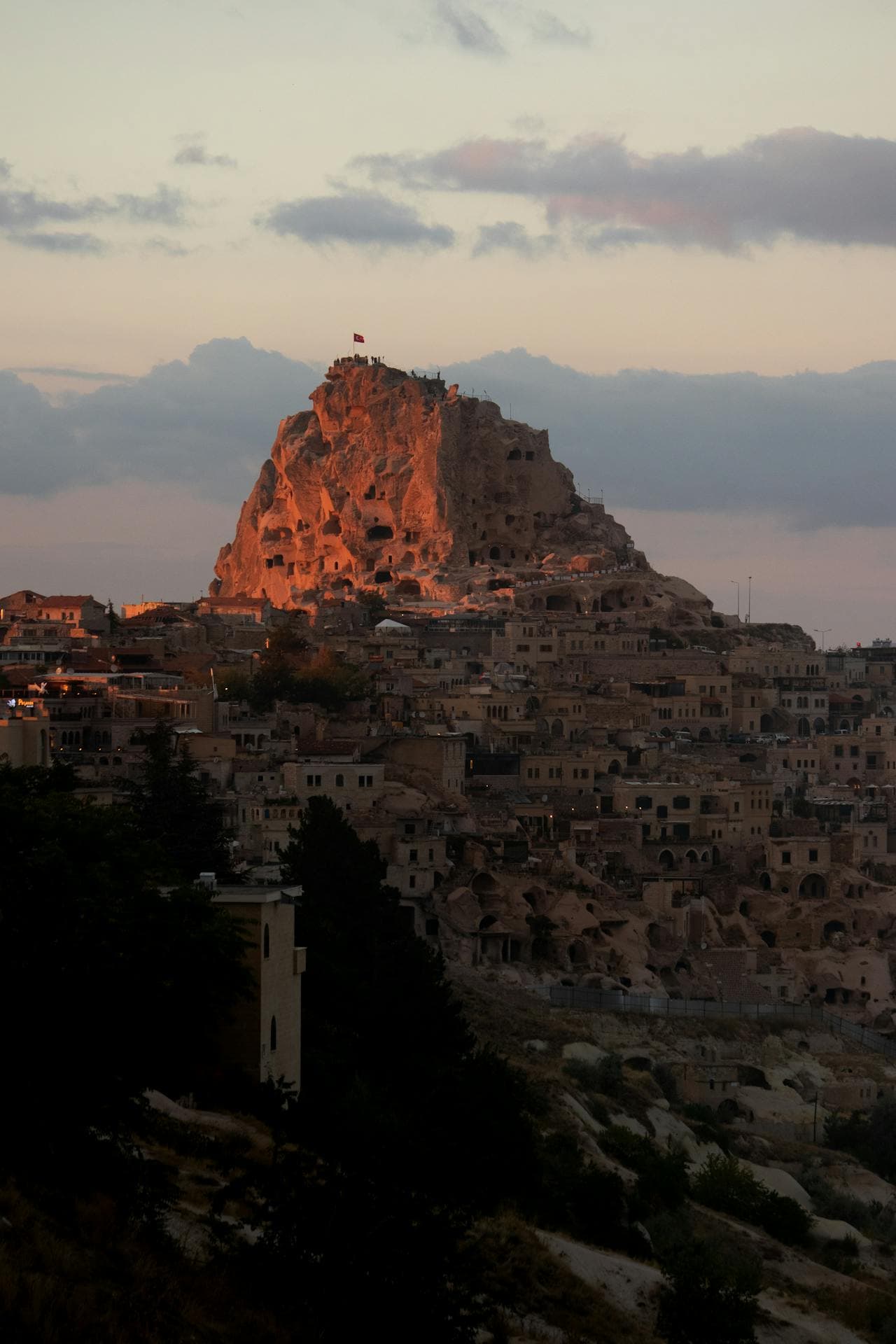
Castles
Uçhisar Castle
Uçhisar Castle is the highest point in Cappadocia — a giant rock fortress you climb for a 360-degree view over Göreme, Pigeon Valley and Mount Erciyes. It isn't a built castle of walls and towers but a single massive outcrop of soft volcanic tuff that generations hollowed into a honeycomb of rooms, tunnels, storage pits and lookout points. At roughly 1,360 metres it towers over the village of Uçhisar, and the short climb to the summit platform is the best way to understand Cappadocia's landscape at a glance. Most visitors photograph the castle from a distance without realising you can go inside and up. Climbing it rewards you three ways: the view, the history you can touch in its carved chambers, and the timing — because it is the tallest point around, it is a front-row seat for both sunrise balloon launches and the golden light of sunset. From the summit you look straight down Pigeon Valley toward Göreme, across a sea of fairy chimneys, with the snow-capped cone of Mount Erciyes on the horizon on clear days. At sunrise, dozens of hot-air balloons rise from the Göreme basin directly in your line of sight. Getting there is easy. From Göreme, about 7 km away, the Göreme–Nevşehir dolmuş minibus stops in Uçhisar, and a taxi takes about 10 minutes. For something more scenic, walk the roughly 4 km Pigeon Valley trail from Göreme — one of the region's best easy hikes — and finish with the castle climb. Go for sunset if you want the best light and the classic golden-hour panorama, or arrive before sunrise to watch the balloons from above. Budget 45 to 60 minutes: about 10 minutes up the carved, railed steps, time at the top, and a wander around the base and the village lanes. It gets genuinely windy and exposed at the summit, so bring a layer even in summer and wear grippy shoes, as the tuff steps can be slick. There is a small entrance fee, so bring cash. Uçhisar itself is worth lingering in, with its cave hotels, viewpoint cafés and craft shops making an easy half-day. The castle is steep in places with real drops, so it is less suitable for anyone with serious mobility limits or a strong fear of heights.
Valleys
White Valley
White Valley, or Bağlıdere Valley, is a pale, sun-bleached canyon in the heart of Cappadocia named for the near-white tufa that glows almost silver in bright light. Locals call it Ak Vadi, meaning White Valley, and you will understand the name the moment you step into it. While the more famous Red and Rose valleys nearby burn with warm colour, this one is soft and chalky, a corridor of cream cliffs, smooth rock waves and honey-coloured stone that seems to brighten as the sun climbs. It links the old village of Çavuşin to Göreme and flows naturally into Love Valley, making it one of the gentlest and most rewarding walks in the whole valley network. The valley has been lived in for a very long time. As you walk you pass rock-cut churches and chapels hollowed out of the soft stone by early Christian communities, some with faint traces of frescoes still clinging to their walls. Even more striking are the elaborate pigeon houses, or güvercinlikler, carved high into the cliff faces and decorated with painted geometric patterns around their little entrance holes. For centuries Cappadocian farmers kept pigeons here not as pets but for their droppings, a prized natural fertiliser that fed the vineyards and orchards on the valley floor. Those vineyards are still there, and in late summer the vines and fruit trees give the pale canyon an unexpected softness. What you will actually see is a mix of quiet drama and gentle beauty. Expect towering columns and clusters of fairy chimneys, wind-smoothed rock that ripples like frozen waves, narrow shaded passages, and wide open stretches where the white walls rise on both sides. As you move toward the Love Valley end, the scenery shifts and the famous tall, slender fairy chimneys begin to appear, some capped with a darker stone that protected the softer rock beneath. It is a lovely contrast: the calm cream walls of White Valley opening onto Love Valley's bold pillars. Getting there is easy. From Göreme the trailhead sits on the edge of town toward Uçhisar and Love Valley, so many people simply walk in. The classic route is the Love and White Valley loop, which most walkers finish in about two to three hours at an easy to moderate pace. If you prefer, dolmuş minibuses run frequently between Göreme, Uçhisar and Nevşehir along the main road, and you can start or end near Uçhisar and walk down. From Ürgüp, take a minibus to Göreme first and continue from there. A taxi to a trailhead is also simple to arrange if you would rather skip the road walking. The best time to visit is early morning or late afternoon. Midday sun is intense and the pale rock reflects the heat, so the softer hours are cooler and the light is far more flattering for photos. Spring and autumn are ideal overall, with mild temperatures and green orchards, while summer is very hot and winter can dust the white cliffs with snow for a magical, quiet scene. Plan on two to three hours for the full loop, or less if you just want a taste of the valley near the Göreme entrance. A few honest tips will make the day better. The valley is free to enter and there is no ticket booth, but bring plenty of water and a hat because shade is limited on the open stretches. Wear proper walking shoes, as the paths can be sandy, dusty or slightly rocky. The trails are not always well marked and can branch or fade, so keep the valley walls as your reference and download an offline map before you set off, since phone signal is patchy. It is usually peaceful here compared with the busier valleys, which is part of its charm, but that also means fewer people around if you get turned around, so it is wise not to hike completely alone at the very end of the day. Carry a little cash for the small family-run tea gardens you may find along the way, where a fresh orange juice or a glass of çay in the shade is the perfect reward.
Open Air Museum
Zelve Open Air Museum
Zelve Open Air Museum is a cluster of three cave-riddled valleys that were lived in as a real village right up until 1952. This is one of the most atmospheric spots in all of Cappadocia, and honestly one of my favourites, because it never feels like a museum. It feels like an abandoned town you have been let loose to explore, with hollowed-out cliffs, tumbledown cave homes, churches, a rock-cut mosque and tunnels burrowing between the valleys. What makes Zelve special is its human story. For centuries this was an important monastic centre in the Byzantine period, then it carried on as an ordinary living village for generations. That is why you find early Christian churches and a later rock-carved mosque sitting in the same rock settlement, a rare snapshot of Cappadocian life shifting across faiths and centuries. By the mid-20th century, erosion and rockfalls made the caves genuinely dangerous, so in 1952 the residents were resettled to a new village nearby called Yeni Zelve (New Zelve). They left, and time simply stopped here. As kids growing up in the region, we used to run around these dwellings playing hide and seek, and it still has that thrilling, slightly wild feeling. Inside the three connected valleys you can wander freely among dozens of cave dwellings, storage rooms and dovecotes carved high into the cliffs. Look out for the little chapels with faded names like Balıklı (Fish), Üzümlü (Grape) and Geyikli (Deer), and the rock-cut mosque, which is one of the few places where you see a minaret and a church community in the same village. There is an old rock-cut mill, and a narrow tunnel that historically linked two of the valleys. It has often been closed for safety, so do not count on crawling through it, but the valleys themselves give you plenty to explore on foot. Getting to Zelve is easy if you are already touring the Avanos side of Cappadocia. It sits just past Paşabağ (Monks Valley) on the road that runs between Göreme, Avanos and Nevşehir. From Göreme it is a short drive or taxi ride, roughly ten minutes by car, and most Red Tour day trips include it alongside Paşabağ and Devrent (Imagination Valley). If you prefer public transport, the Göreme to Avanos dolmuş (shared minibus) runs frequently through the day and can drop you near the Paşabağ and Zelve turnoff, from where it is a manageable walk to the entrance. It is very doable to link Paşabağ and Zelve on foot in a single relaxed morning. The best time to come is early morning or late afternoon, both for softer light and to arrive ahead of the tour coaches that cluster around midday. Give yourself around one to one and a half hours to take in all three valleys properly without rushing. Spring and autumn are the loveliest seasons, with kinder temperatures and green in the valley floors. A few honest tips from experience. Wear proper grippy shoes, because the ground is uneven, rocky and involves a bit of scrambling in places. There is very little shade, so bring water and a hat in summer, when it gets genuinely hot. A small torch is handy if any of the tunnels or darker caves are open. Take real care near the cliff edges and inside crumbling structures, and keep an eye on children, because this is a natural, lightly managed site rather than a sanitised attraction. There is a small entrance fee, and it is worth carrying some cash. Facilities at the entrance are basic, with a simple cafe and toilets, so it is not a place to linger for lunch. Combine it with Paşabağ, Devrent and Çavuşin for a full and rewarding half-day, and you will come away feeling you have seen the real, lived-in Cappadocia rather than just its postcard version.
Valleys
Zemi Valley
Zemi Valley is one of the greenest and quietest walks around Göreme, a shaded streamside trail that most day-trippers never find. While the red and rose valleys nearby are famously arid and sun-baked, Zemi keeps a different character. A seasonal creek runs along its floor, and where there is water in Cappadocia there is life: poplars, wild fruit trees, walnut and mulberry, and a tangle of green that turns the whole ravine soft and cool. That single difference is why locals and slow travelers love it. On a scorching July afternoon when the open valleys shimmer with heat, Zemi stays leafy and merciful, and the loudest sound is usually birdsong or the crunch of your own boots. The valley runs roughly south of Göreme town toward the Open-Air Museum ridge, and it has been quietly lived in and worked for centuries. As you walk you will pass classic fairy chimneys and soft tuff cliffs pierced with hand-carved openings. Many of these are old pigeon houses, or dovecotes, where villagers collected pigeon droppings to fertilize their orchards and vineyards, a practical tradition that shaped Cappadocian farming for generations. Look closer and you will also spot dark doorways leading into cave chambers and rock-cut rooms, most of them empty and unvisited, a reminder that people have carved homes, stables, and storerooms into this stone for a very long time. Zemi is best known among walkers for its hidden churches. The little El Nazar Church sits near the mouth of the valley, a cross-shaped chapel carved from a free-standing cone with faded frescoes inside. Deeper along, the aptly named Saklı, or Hidden, Church earns its name by tucking almost invisibly into the rock, easy to walk straight past unless you know to look. These are humble, atmospheric places rather than grand monuments, and finding them is part of the pleasure. Getting here is refreshingly simple. From the center of Göreme you can reach the trailhead on foot in a short walk, following the road toward the Open-Air Museum and dropping into the valley near there. If you are coming from Ürgüp or Nevşehir, take one of the frequent dolmuş minibuses into Göreme first, then start on foot from town. There is no ticket booth and no entrance fee for the valley walk itself, though the separate Göreme Open-Air Museum nearby does charge admission if you decide to combine the two, which many people do. Plan on roughly one and a half to two and a half hours for a relaxed there-and-back walk, longer if you linger at the churches or picnic in the shade. The trail is mostly easy with a few gentle, uneven stretches, suitable for anyone reasonably comfortable on natural paths. Spring is glorious, with blossom and wildflowers, and autumn brings golden leaves, but the valley truly earns its reputation in high summer as the coolest, shadiest hike near Göreme. Early morning is loveliest for soft light and solitude; late afternoon is pleasant too, but do not leave it so late that you are finding your way out in the dark. A few honest tips. After rain the streamside sections can get genuinely muddy and slippery, so wear shoes with grip rather than sandals. Bring water and a snack, because there are no shops or cafes inside the valley itself. The path is not heavily signposted and side trails can be confusing, so a downloaded offline map is worth having, and it is easy to ask a local in Göreme to point you toward the right trailhead. The Hidden Church in particular is famous for being missed, so keep an eye out or ask someone who has walked it recently. Finally, treat the churches and cave rooms gently, take nothing, and carry your rubbish back out with you. Zemi rewards the traveler who wants Cappadocia without the crowds: green, cool, quietly historic, and easy to reach on your own two feet. Pair it with the Open-Air Museum, El Nazar, or a nearby valley for a full and unhurried day among the fairy chimneys.